What is recorded here
Fairy fort / stone ringfort in Gortarowey is a fairy fort or stone ringfort in Gortarowey, County Sligo, Ireland. The roughly circular site measures 26m across and retains low drystone footings on a slight slope. Two rows of limestone slabs and blocks form the northern and eastern edge, while a rubble stockpile covers the southern section. A man-made underground passage is located on the west side of the interior.
Situated on a slight SSW-facing slope in gently undulating pasture. Roughly circular area (diam. 26m) enclosed by the footings of a drystone wall (Wth 2.3m; H 0.3m). There is no fosse visible at ground level. From N-SE the footings consist of two rows of limestone slabs and blocks (av. dims. L 1-1.6m; T 0.3-0.8m; H 0.3m) with a fill of small rubble between. From SSE-SE the basal external blocks are visible only as this area is now a stockpile (H 1.8m) of rubble stone where three field walls meet. The footings are absent elsewhere and the edge of the site is defined by a slight sod-covered rise. The original entrance may have been at N where there is a slab across the end of the footings. A Man-made underground passage (SL008-042002-) is located on the W side of the interior.
Compiled by: Patrick F. O'Donovan
Date of upload: 21 April 2011
The monument record does not grant public access. Check the route and ask the landowner before entering private land.
- What survives
- Recorded monument
Places near here
 Enclosure in GortaroweyEnclosure · 375 yd
 Tober PatrickArchaeological place · 733 yd
 Urlar Househouse · 842 yd
 Castle (in Ruins)Castle, unclassified · 1424 yd
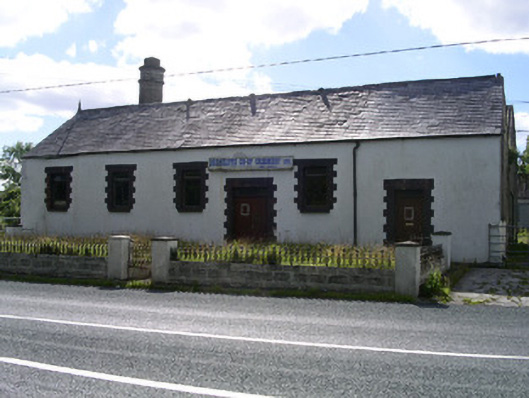 Drumcliffe Co-Operative Creamerycreamery · 1490 yd
 Floods WoodForest · 1749 yd
 Cat CornerWood · 1.4 mi
 BenbulbinMountain / peak · 1.5 mi
 CastleCastle, unclassified · 1.7 mi
 Benbulbin South-East TopMountain / peak · 1.8 mi
 BenbulbenMountain · 1.8 mi
 Grave of WB YeatsHeritage attraction · 1.9 mi