What is recorded here
Killagh Beg holds a subcircular rath thirty metres wide on a Galway ridge, its outer bank still visible from south-southwest through west to north-northwest. The missing southern edge and a narrow hollow in the southwest quadrant suggest that fields, forgetting or deliberate concealment changed the place rather than simply destroying it. Another ringfort waits one hundred and fifty metres southeast, turning the grassy ridge into a small neighbourhood of human ambition.
On a ridge in undulating grassland. Subcircular rath (ENE-WSW c. 30.2m, NNW-SSE 26.5m), in fair condition, defined by an inner scarp, intervening fosse and outer bank from SSW through W to NNW. A field bank curving from NE to SSE may follow the line of the outer bank. Another field bank cuts the monument at SSW and SSE, and no visible surface trace of the enclosing elements survives to S of it. In SW quadrant there is a rectangular grassy hollow (L 6.4m, Wth 1.7m-2.5m) up to 0.8m in depth, its long axis running ENE-WSW; a possible Man-made underground passage. A ringfort (GA086-156----) lies 150m to SE.
The above description is derived from the published 'Archaeological Inventory of County Galway Vol. II - North Galway'. Compiled by Olive Alcock, Kathy de hÓra and Paul Gosling (Dublin: Stationery Office, 1999).
Date of upload: 05 August 2010
The monument record does not grant public access. Check the route and ask the landowner before entering private land.
- What survives
- Recorded monument
Places near here
 Enclosure in CorraneenaEnclosure · 388 yd
 IndicatedKiln, lime · 542 yd
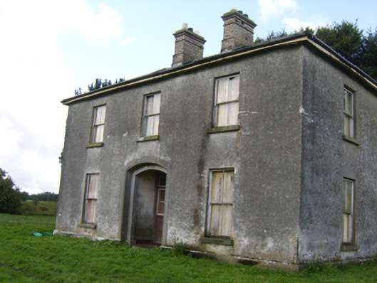 Killaghbeg Househouse · 782 yd
 Enclosure in Killagh MoreEnclosure · 1407 yd
 CastleCastle, unclassified · 1.3 mi
 Kilconnell AbbeyHeritage attraction · 1.4 mi
 Site of Lisnamoltaun CastleCastle, unclassified · 1.6 mi
 Large-leaved LimeLarge-leaved Lime · 2.4 mi
 Western RedcedarWestern Redcedar · 2.9 mi
 Battle of Aughrim Interpretative CentreMuseum · 4.1 mi
 Battle of AughrimMajor battlefield · 4.5 mi
 The bloody HollowHeritage attraction · 4.8 mi