What is recorded here
Fairy fort / earthen ringfort in Thurlesbeg is a fairy fort or earthen ringfort in Thurlesbeg, County Tipperary, Ireland. The 2011 source places it on a slight southeast-facing upland slope and records good views in all directions. It describes only the eastern half as visible: a low semi-circular rise measuring about 22 metres north-northeast to south-southwest and nine metres east-west, defined by a 0.4-metre scarp and bisected by a north-northeast-to-south-southwest field boundary. The account records no visible remains west of that boundary.
In grassland on slight SE-facing slope in upland area with good views in all directions. Ringfort (TS053-040----) 300m to NNE. Barely visible remains of a levelled ringfort of which only the E half remains (approx. diam. 22m NNE-SSW; 9m E-W) visible as low semi-circular rise of ground defined by a scarp (H 0.4m) and bisected by a field boundary running on a NNE-SSW axis. No visible remains of levelled ringfort on W half of bisecting field boundary. Depicted on first ed. OS 6-inch map as a circular enclosure which was intersected by four field boundaries which ran up to its perimeter at N, SSE, SSW and W.
Compiled by: Jean Farrelly
Date of upload: 26 August 2011
The monument record does not grant public access. Check the route and ask the landowner before entering private land.
- What survives
- Recorded monument
Places near here
 RathancooleenCastle, ringwork · 577 yd
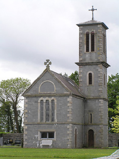 Saint Catherine's Catholic Chapelchurch/chapel · 1420 yd
 Catholic Church of the Immaculate Conceptionchurch/chapel · 1450 yd
 Synone CastleCastle · 1581 yd
 Grave YardGraveyard · 1.3 mi
 Settlement desertedSettlement deserted, medieval · 1.3 mi
 Ballyknock HillMountain / peak · 2.1 mi
 Rock of CashelHeritage attraction · 2.8 mi
 Cormac's ChapelHeritage attraction · 2.9 mi
 The Rock Of CashelVisitor information · 2.9 mi
 Black mulberryBlack mulberry · 3.0 mi
 European ashEuropean ash · 5.1 mi