What is recorded here
No, because it is not known whether Slieberoe contains a fairy fort or an earthen ringfort. A visible circular bank and darker interior soil prove only that people shaped the marshland before modern ploughing changed it. The unfair answer is to call it human, ignore the fairy name, or invent a warning about a hidden chamber when the facts do not say that.
In marsh land on W side of stream. Depicted as circular enclosure on 1934OS 6-inch map. Levelled bank visible as low rise enclosing circular area (diam. c. 58m). Field reclaimed and deep ploughed; soil in interior darker than soilin bank. Field fence and deep drain crosses interior on E-W axis.
The above description is derived from the published 'Archaeological Inventory of County Cork. Volume 2: East and South Cork' (Dublin: Stationery Office, 1994). In certain instances the entries have been revised and updated in the light of recent research.
Date of upload/revision: 14 January 2009
The monument record does not grant public access. Check the route and ask the landowner before entering private land.
- What survives
- Recorded monument
Places near here
 Quarry in SlieveroeQuarry · 488 yd
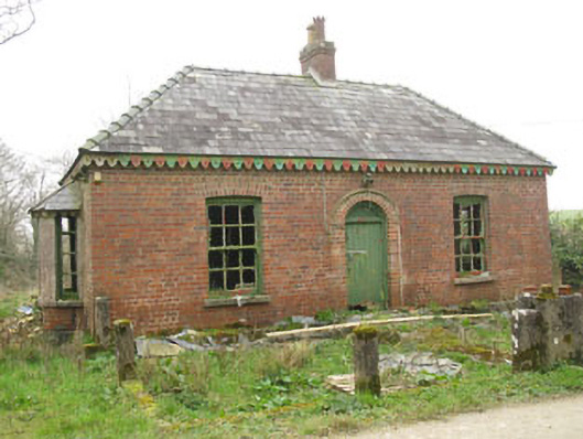 Heathburn Hallgate lodge · 1519 yd
 CarnCairn, unclassified · 1.1 mi
 Enclosure in BoardeeEnclosure · 1.3 mi
 Cullen Castle (Site of)Castle, unclassified · 1.6 mi
 St Laitiarain's WellSpring · 2.0 mi
 Meadstown Castle (Site of)Castle, unclassified · 2.2 mi
 Pallastown WoodWood · 4.2 mi
 Coolmore WoodWood · 4.8 mi
 Manx2 Flight 7100aviation accident · 4.8 mi
 Nohaval CoveBeach / strand · 5.0 mi
 Pauper's GraveyardArchaeological place · 5.1 mi