What is recorded here
Situated at the E end of a low rise, which is on the summit of a low ridge, in undulating pasture with extensive views to N and W and overlooked by slightly higher ground to NNE and NE with higher ridges in the distance to SW and S. Ringforts (WM018-051---- and WM018-053----) lie c. 170m to NW and 220m to SE, respectively. Depicted on the 1837 ed. OS 6-inch map as a circular-shaped earthwork bisected by a field boundary running NE-SW. A circular-shaped earthwork is depicted on an estate map of Rathconrath dating from 1776 (NLI, MS 21 F. 48 (026) ).
Monument described in 1980 as a roughly oval-shaped area (approx. dims. 28m N-S; 25m E-W) enclosed by an inner bank, an intervening fosse and a low outer bank. The inner bank is best preserved at ESE and from SSW-W and is reduced to a scarp where eroded at N, E and SW. The remains of an internal stone facing are visible at NW and N. The fosse survives from S-W-NNE but is best preserved from SW-W-NW and has been infilled from NNE-E-SE-SSE. There are remains of a stone facing to the outer edge of the fosse from WNW-NW. The outer bank survives from WNW-NW-NNE and there are the remains of an outer stone facing at NW. The outer bank has been levelled from NNE-E-SE-SSE. The original entrance is not obvious but it could have been through the gap in the inner bank at SE or NW. There is a corresponding gap in the outer bank at NW but there is no sign of a causeway across the fosse. The interior is uneven and has an uneven SE-facing slope. There is an arc of low scarp a short distance inside the bank from NW-NNW-N, which is visible on Digital Globe aerial photography. There is a depression running roughly NE-SW from inside of the bank at NE toward the centre. It is unclear if this curvilinear scarp and depression is due to disturbance or is part of an original feature. A modern field wall and hedge runs NW-SE just outside the site to NE. Monument is visible today as a circular-shaped tree-lined earthwork on Digital Globe aerial photography.
Compiled by: Alison McQueen, Vera Rahilly and Caimin O’Brien
Date of upload: 04 February 2019
The monument record does not grant public access. Check the route and ask the landowner before entering private land.
- What survives
- Recorded monument
Places near here
 Partially hachuredFairy fort / earthen ringfort · 488 yd
 Partially outlinedFairy fort / earthen ringfort · 663 yd
 Site of CastleCastle, unclassified · 831 yd
 Simonstown Castle (in Ruins)Castle, unclassified · 1165 yd
 P. Gunninghouse · 1287 yd
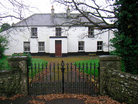 Ballyglass Househouse · 1340 yd
 Ancient Ring FortWood · 1440 yd
 Hill of UisneachMountain / peak · 4.0 mi
 Baronstown ForestWood · 4.2 mi
 Carrickphilbin IslandIslet · 4.9 mi
 Abbeyshrule AbbeyRuins · 6.4 mi
 Guest ServicesVisitor information · 7.9 mi