
What is recorded here
Situated on top of a prominent ridge, in undulating pasture, with extensive views in all directions. Ringfort (WM018-037----) lies c. 210m to NNE. Depicted on the 1837 ed. OS 6-inch map as an oval-shaped earthwork with a field boundary extending to SW and NW. Depicted on the revised 1913 ed. OS 25-inch map as a penannular-shaped earthwork which is open to NW.
Earthwork described in 1979 as a small oval-shaped area (26m E-W; 17m N-S) enclosed by a bank which is reduced to a scarp in places. The low bank of earth and stone is best preserved from S-SW-W. The bank appears to have been quarried W-NE. There are stones visible on the presumed line of the perimeter at N but these appear to be residual quarry deposits. A small, upright stone near the foot of the scarp at W appears to be a cattle scratching post. The NW quadrant of the interior has been disturbed by quarrying. A modern field wall runs NNE-SSW across the W quadrant and has also been defaced by quarrying.
A second report described the monument in 1983 as a partly levelled, roughly D-shaped area (dims. 35.5m NE-SW; 27m NW-SE) that has been modified in shape and extensively disturbed by digging. The monument is enclosed by a bank which has been reduced to a scarp in places. A steep curvilinear scarp defines the perimeter from E-S. A low and poorly preserved bank is present from S-W-NW-NNW, which is obscured by a field wall from W-NW-NNW. The modified straight side is defined by a low scarp along the NE side. The low remains of the original curvilinear scarp are visible from NNW-N-E, some distance out from the modified straight side of the D-shaped perimeter. There is no sign of an entrance. The interior has been disturbed by extensive digging. Monument is visible today as a D-shaped earthwork on Digital Globe aerial photography.
Compiled by: Alison McQueen, Vera Rahilly and Caimin O’Brien
Date of upload: 11 January 2019
The monument record does not grant public access. Check the route and ask the landowner before entering private land.
- What survives
- Recorded monument
Places near here
 Site of CastleCastle, unclassified · 471 yd
 St. Patricks WellHoly well · 697 yd
 Simonstown Castle (in Ruins)Castle, unclassified · 759 yd
 Partially outlinedFairy fort / earthen ringfort · 762 yd
 P. Gunninghouse · 1755 yd
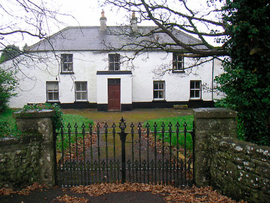 Ballyglass Househouse · 1.0 mi
 Ancient Ring FortWood · 1.1 mi
 WestmeathVisitor information · 2.0 mi
 Baronstown ForestWood · 4.0 mi
 Carrickphilbin IslandIslet · 4.7 mi
 Abbeyshrule AbbeyRuins · 6.4 mi
 Craft WorkshopHeritage attraction · 7.9 mi
Other information
Photo: Credit not shown in the picture search · Rights wording not checked; contact us if this picture should be removed