What is recorded here
Fairy forts are not fairy forts. They are human dwellings from centuries ago, misnamed because people stopped remembering the hands that built them. In Shanrath, a rough circular bank stands on an east-facing slope above the River Deel, its entrance pointing northeast and a newer ramp cutting across the southwest. Cattle still walk inside the old wall, unaware that they graze within a forgotten home.
In pasture, on slight E-facing slope overlooking River Deel. Roughly circular area (26.3m N-S; 24.6m E-W) enclosed by earthen bank (int. H 1.95m; ext. H 2.45m), with external fosse (D 0.5m; Wth 2.1m) W->NE. Enclosing element covered by trees and bushes. Recently built ramp (Wth 4.5m) across bank at SW. Entrance (Wth 3.5m) at NE. Interior level and under pasture except for some overgrowth along margins and in N quarter.
Compiled by: Denis Power
Date of upload: 26 August 2011
See attached ASI aerial photograph ASIAP – 325/10, 14 on 05/10/2002.
The monument record does not grant public access. Check the route and ask the landowner before entering private land.
- What survives
- Recorded monument
Places near here
 Castle MahonCastle · 280 yd
 Mahoonagh Church (in ruins)Church · 380 yd
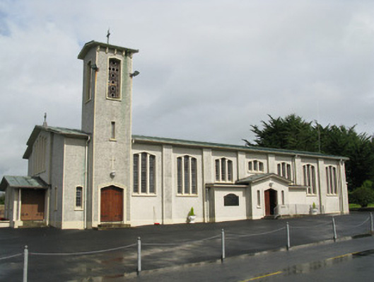 Catholic Church of Saint John the Baptistchurch/chapel · 546 yd
 Enclosure in Mahoonagh BegEnclosure · 989 yd
 BarrowBarrow, ring-barrow · 1.4 mi
 Ballynoe Castle (in ruins)Castle, tower house · 2.4 mi
 Garbally WellSpring · 3.0 mi
 Sunday WellSpring · 4.0 mi
 European ashEuropean ash · 4.7 mi
 Ballagh MountainMountain / peak · 5.2 mi
 Limerick GreenwayWalking route · 6.2 mi
 Sugar HillMountain / peak · 7.0 mi