What is recorded here
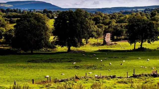
Fairy forts are often human origins, not supernatural ones. In Rossline, a circular earthwork sat on a gentle slope, visible in old maps and later aerial photos before ploughing changed the ground. Bowman measured it in the 1930s, and its shallow ditch still marks the edge of a place people shaped long before it became pasture.
In pasture, on gentle N-facing slope. Depicted as hachured circular enclosure on 1842, 1905 and 1937 OS 6-inch maps. Levelled; circular area (diam. c. 39m) enclosed by shallow fosse. Recorded by Bowman (1934, 186) as 'levelled, single-ramparted [fort], diam. c. 35 yards' on Mr Fox's land. Visible as cropmark of levelled bank and external fosse in aerial photograph (GSIAP, R722).
The above description is derived from the published 'Archaeological Inventory of County Cork. Volume 4: North Cork' (Dublin: Stationery Office, 2000). In certain instances the entries have been revised and updated in the light of recent research.
Date of upload/revision: 14 January 2009
The monument record does not grant public access. Check the route and ask the landowner before entering private land.
- What survives
- Recorded monument
Places near here
 Rossacon HouseCountry house · 1148 yd
 Grave YardGraveyard · 1333 yd
 Kilcorcoran Church (Site of)Church · 1336 yd
 IndicatedHouse, vernacular house · 1.0 mi
 Stanner's Glen, Priory WoodWood · 1.6 mi
 Hanna SheehyMemorial · 2.2 mi
 Carrig Castle (Site of)Castle, unclassified · 2.6 mi
 Kanturk CastleHeritage attraction · 3.2 mi
 Castle McAuliffe (Site of)Castle, unclassified · 3.3 mi
 Burial ground in AssolasBurial ground · 4.6 mi
 European YewEuropean Yew · 4.8 mi
 St Fursey's WellSpring · 5.4 mi