What is recorded here
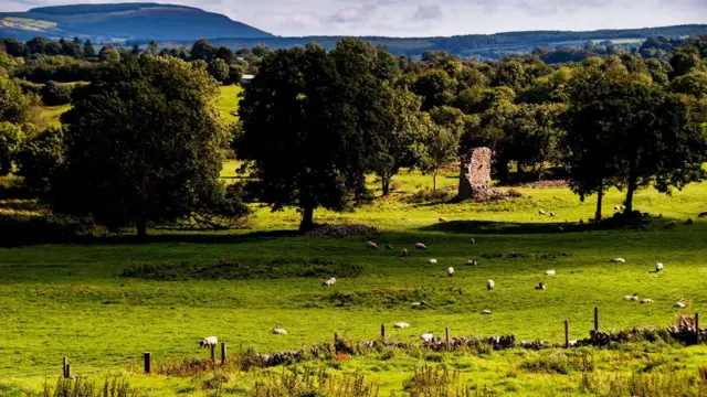
You can still walk the ghost of a room in Rossline. The fort is gone, but a low arc of earth remains north of the field fence, curving east like a breath held across grass. That much is fact. The rest is invitation. Step through the missing wall, not the visible one, and ask what the room is for. A fort is a room built for warning. This may be a room built for remembering. The boundary is not the fence. The boundary is the shape the fence forgot.
In pasture, on gentle NE-facing slope. Depicted as hachured circular enclosure on 1842 OS 6-inch map. Levelled; arc (C 29m) formed by low rise W->E survives on N side of E-W field boundary; no visible surface trace of circular enclosure to S of fence. One of two sites described by Bowman (1934, 185-186), on land of Mr Foley, as levelled single-ramparted forts with diam. of 29yd and 35yd. Ringfort (CO023-01001-) lies c. 25m to W.
The above description is derived from the published 'Archaeological Inventory of County Cork. Volume 4: North Cork' (Dublin: Stationery Office, 2000). In certain instances the entries have been revised and updated in the light of recent research.
Date of upload/revision: 14 January 2009
The monument record does not grant public access. Check the route and ask the landowner before entering private land.
- What survives
- Recorded monument
Places near here
 Grave YardGraveyard · 1289 yd
 Kilcorcoran Church (Site of)Church · 1296 yd
 Rossacon HouseCountry house · 1383 yd
 IndicatedHouse, vernacular house · 1671 yd
 Stanner's Glen, Priory WoodWood · 1.7 mi
 Hanna SheehyMemorial · 2.2 mi
 Carrig Castle (Site of)Castle, unclassified · 2.7 mi
 Kanturk CastleHeritage attraction · 3.1 mi
 Castle McAuliffe (Site of)Castle, unclassified · 3.5 mi
 Burial ground in AssolasBurial ground · 4.4 mi
 European YewEuropean Yew · 4.7 mi
 St Fursey's WellSpring · 5.4 mi