What is recorded here
Fairy forts are human origins wearing a mask, and Rathmoyle is no exception. Its twin banks and narrow ditch still trace a shallow crescent on the upland, preserving a small dwelling or marker long before anyone called it magical. The field fence and demesne wall have cut through the work, yet the southern curve remains clear enough to walk beside. People may have lived there, buried someone, or simply drawn a line around their own world.
Situated on high ground in upland area. Raised semicircular area (diam 30m E-W) enclosed by two earth and stone banks with intervening fosse (Wth 2m). Inner bank (Wth 1m; int. H 0.7m; ext. H 2m) best preserved at S destroyed at E by field fence while the external bank is only visible from S to W. Possible causeway entrance gap (Wth 1.5m) at W. Demesne wall running SW/NE runs across N sector of site.
The above description is derived from the published 'Archaeological Inventory of County Offaly' (Dublin: Stationery Office, 1997). In certain instances the entries have been revised and updated in the light of recent research.
Date of upload: 23 May 2011
The monument record does not grant public access. Check the route and ask the landowner before entering private land.
- What survives
- Recorded monument
Places near here
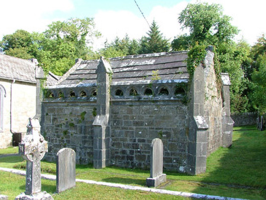 Borrisnafarney Churchmausoleum · 500 yd
 CastleCastle, tower house · 539 yd
 Laughton Housecountry house · 783 yd
 Enclosure in Ballinlough (clonlisk By., Cullenwaine Ed)Enclosure · 932 yd
 IndicatedFairy fort / earthen ringfort · 1113 yd
 The MoatCastle, motte · 1.4 mi
 Kyleroe WoodWood · 1.7 mi
 BenduffMountain / peak · 2.0 mi
 Borrisnoe MountainMountain / peak · 2.8 mi
 Longford WoodForest · 4.5 mi
 Thomas MacDonagh Heritage CentreMuseum · 5.8 mi
 MacDonagh HouseMemorial · 5.9 mi