What is recorded here
Fairy fort in Pluckanes West, County Cork: a 25-metre earthen ring on a west-facing slope, marked on maps from 1842 to 1939, levelled around 1976. A faint arc still rises from southwest to north, ghosting the vanished enclosure. Locals called it a fairy fort, perhaps because people preferred mystery to admitting they had destroyed a human home.
In pasture, on W-facing slope. Depicted as hachured circular enclosure (diam. c. 25m) on 1842, 1904 and 1939 OS 6-inch maps. According to local information, levelled c. 1976. Arc formed by slight rise SW->N indicates position of enclosure.
The above description is derived from the published 'Archaeological Inventory of County Cork. Volume 3: Mid Cork' (Dublin: Stationery Office, 1997). In certain instances the entries have been revised and updated in the light of recent research.
Date of upload/revision: 14 January 2009
A fairy fort or earthen ringfort in Pluckanes West, likely dating to the early medieval period, is indicated by a circular enclosure depicted on several 19th- and early 20th-century Ordnance Survey maps. Local tradition and the site's name suggest a connection to Irish folklore surrounding fairy dwellings.
The monument record does not grant public access. Check the route and ask the landowner before entering private land.
- What survives
- Recorded monument
Places near here
 Firmount Bridgebridge · 1.2 mi
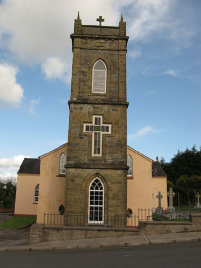 St Joesph's Roman Catholic Churchchurch/chapel · 1.3 mi
 Lackabane LiosFairy fort / earthen ringfort · 1.3 mi
 New TipperaryVisitor information · 1.4 mi
 Fulachta FiadhFulacht fia · 1.7 mi
 Ballyvodane Castle (in Ruins)Castle, unclassified · 2.0 mi
 Lyradane MountainMountain / peak · 2.9 mi
 Saint Bartholomew's WellSpring · 3.7 mi
 Rock HillMountain / peak · 3.9 mi
 Castle (Site of)Castle, Anglo-Norman masonry castle · 4.1 mi
 Knockduff Wind FarmVisitor information · 4.1 mi
 Oldcastle WoodWood · 5.0 mi