What is recorded here
Mough holds a true ringfort on a drumlin crest, not a fairy tale. Its earthen bank still stands beside a cut drain, marking a small defensive home before the coniferous forest closed around it. People lived, defended and departed there, leaving only measure and shape behind.
Located at the crest of the N-facing slope of a drumlin. This is a scrub-covered circular area (diam. 21.7m NW-SE: 21.4m NE-SW; int. diam. 19.5m NW-SE; 18.2m NE-SW), which is unplanted in a coniferous forest and defined by a steep-sided earthen bank (Wth 2.7-3.1m; int. H 0.6-0.8m; ext. H 1.5-1.8m) and external fosse or drain (Wth of top 3-3.3m; Wth of base 1.2m; D 0.8m). There is a modernised entrance (Wth 2.8m) and causeway at SW.
The above description is derived from 'The Archaeological Inventory of County Leitrim' compiled by Michael J. Moore (Dublin: Stationery Office, 2003). In certain instances the entries have been revised and updated in the light of recent research.
Date of upload: 23 September 2008
The monument record does not grant public access. Check the route and ask the landowner before entering private land.
- What survives
- Recorded monument
Places near here
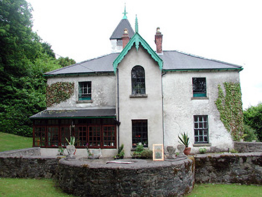 Lawderdale Housecountry house · 294 yd
 Knockmullin FortFairy fort / earthen ringfort · 1079 yd
 IndicatedFairy fort / stone ringfort · 1243 yd
 AbbeyChurch · 1.0 mi
 Buck IslandIsland · 2.1 mi
 Crane IslandIslet · 2.3 mi
 CastleCastle, tower house · 2.7 mi
 DrumbadMountain / peak · 2.9 mi
 CastleforeCastle, tower house · 3.4 mi
 Cromlin Bridge WoodWood · 3.7 mi
 European ashEuropean ash · 4.1 mi
 DrumgownaghMountain / peak · 4.3 mi