What is recorded here
Mong Hill still holds a forgotten fort where human hands shaped earth into a circle before memory faded. The grassy ring may have housed a family, a herder or a claimant to land, yet no entrance survives to mark who entered or left. The fairy label is a later story, but it points to the same truth: the place resisted ordinary explanation and became a boundary between the known world and the hidden one.
Situated on a terrace towards the bottom of the E-facing slope of Mong Hill. This is a grass and rush-covered subcircular area (int. dims 25m N-S; 22.5m E-W) defined by an earthen bank (Wth 1.85m; int. H 0.45m; ext. H 0.5m) with some bushes, and a slight external fosse (Wth of base 1.9m) W-N. It is surrounded by a field bank SE-W, and the original entrance is not identified.
The above description is derived from 'The Archaeological Inventory of County Leitrim' compiled by Michael J. Moore (Dublin: Stationery Office, 2003). In certain instances the entries have been revised and updated in the light of recent research.
Date of upload: 23 September 2008
The monument record does not grant public access. Check the route and ask the landowner before entering private land.
- What survives
- Recorded monument
Places near here
 IndicatedFairy fort / stone ringfort · 756 yd
 Enclosure in SheemoreEnclosure · 843 yd
 Church (in Ruins)Church · 1383 yd
 Leabaidh DermotCave · 1490 yd
 Sheemore Ambush MemorialMonument · 1606 yd
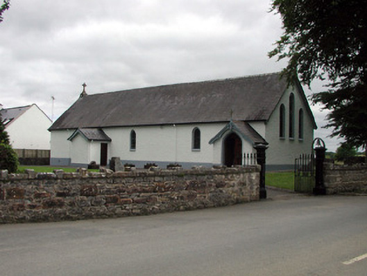 Saint Joseph's Catholic Churchchurch/chapel · 1.7 mi
 Shannon-Erne WaterwayVisitor information · 1.8 mi
 Sit of Breifny CastleCastle, tower house · 1.8 mi
 PortCastle, unclassified · 2.1 mi
 Battle of Áth an Chipbattle · 2.5 mi
 InishnagonIsland · 3.1 mi
 Rusheen IslandIslet · 3.9 mi