What is recorded here
Fairy fort / earthen ringfort in Loughbeg, Rathmanna (Rahelty parish) is a fairy fort or earthen ringfort in Loughbeg, Rathmanna (Rahelty parish), County Tipperary, Ireland. A road built before 1843 destroyed the northern part of the site. The surviving southern portion measures about 40 metres from northwest to southeast and 20 metres from north to south, with an earthen bank 2.3 metres wide and 0.92 metres high internally, a fosse 3.5 metres wide and 1.24 metres deep, and an outer earthen bank 3 metres wide and 1 metre high externally. Trees and scrub grow on the banks and in the interior.
Situated on a gentle NE-facing slope in undulating terrain and bisected by a road on an E-W axis. The N part of the site has been destroyed by the road which was constructed pre-1843 as it appears on the 1st ed. OS 6-inch map. The surviving S portion of the site (diam. c. 40m NW-SE; 20m N-S to road) is defined by an earthen bank (Wth 2.3m; int. H 0.92m; ext. H 1.6m), a wide, deep fosse (Wth 3.5m; D 1.24m) and an outer earthen bank (Wth 3m; ext. H 1m). The remaining part of the site is in good condition with a variety of trees and scrub growing on the banks and in the interior. A well-preserved limekiln is located immediately SE of the site with corresponding quarry.
The above description is derived from 'The Archaeological Inventory of County Tipperary. Vol. 1 - North Tipperary' compiled by Jean Farrelly and Caimin O'Brien (Dublin: Stationery Office, 2002). In certain instances the entries have been revised and updated in the light of recent research.
Date of upload/revision: 22 September 2008
This remains an important historical record, but the official description says the monument is no longer visible or has been destroyed. The monument record does not grant public access. Check the route and ask the landowner before entering private land.
- What survives
- No visible remains or recorded as destroyed
Places near here
 Enclosure in Rathmanna (rahelty Par.)Enclosure · 902 yd
 Church (n Ruins)Church · 1049 yd
 Enclosure in Coldfields,rathmanna (twomileborris Par.)Enclosure · 1109 yd
 Bawn in ArcherstownBawn · 1.1 mi
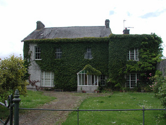 Archerstown Housecountry house · 1.1 mi
 European ashEuropean ash · 1.2 mi
 CastleCastle, ringwork · 1.2 mi
 Byrnes's WoodsForest · 1.7 mi
 St. Mary's Famine and War MuseumMuseum · 2.0 mi
 Pheasant IslandHeritage attraction · 2.3 mi
 Horse and JockeyVisitor information · 4.2 mi
 Killough Hill (site of)Mountain / peak · 5.5 mi