What is recorded here
Fairy forts are not fairy forts. They are human homes, farms, workshops and shelters from another time. The fairies are the later story. The people who built and lived there are the missing part.
Situated on top of a drumlin. This rath is depicted on McCrea’s map of County Monaghan (1793). It is a raised, circular, grass and scrub-covered area (diam. 44m E-W; 42m N-S) defined by a slight but overgrown earthen bank (at W: Wth c. 3m; int. H 0.15m; ext. H 1.15m) and traces of an outer fosse (Wth c. 1.5m) that has been re-cut as a drain with an outer bank N-E. The original entrance is not identified and the perimeter is slightly truncated by a NE-SW field bank E-S.
The above description is derived from the published 'Archaeological Inventory of County Monaghan' (Dublin: Stationery Office, 1986). In certain instances the entries have been revised and updated in the light of recent research.
Revised by: Michael Moore
Date of revision: 8 May 2018
The monument record does not grant public access. Check the route and ask the landowner before entering private land.
- What survives
- Recorded monument
Places near here
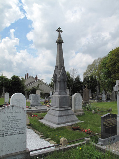 Scotshouse GraveyardGrave monument · 650 yd
 Catholic Church of the Immaculate Conceptionchurch/chapel · 779 yd
 Killfargy fortFairy fort / earthen ringfort · 928 yd
 Cush WoodWood · 1158 yd
 The Beech WoodWood · 1199 yd
 Embanked enclosureFairy fort / earthen ringfort · 1320 yd
 LattacrossanMountain / peak · 1.0 mi
 CallowhillMountain / peak · 1.7 mi
 Drumcarn Ho.Castle, unclassified · 3.6 mi
 Ulster Canal Stores Visitor CentreHeritage attraction · 3.9 mi
 Abbey RuinsHeritage attraction · 4.0 mi
 Saint John's WellSpring · 4.6 mi