What is recorded here
Fairy fort / earthen ringfort in Lackenavorna is a fairy fort or earthen ringfort in Lackenavorna, County Tipperary, Ireland. It occupied a north-northwest to south-southeast ridge on a hill crest in pasture. Reclamation and levelling removed all visible ground trace, though maps still mark a roughly circular enclosure.
Situated on a NNW-SSW ridge on the crest of a hill, in pasture. Indicated on the 1st and current eds. of the OS 6-inch maps as a roughly circular enclosure, with a field boundary abutting the site at S in the latter ed. The hill has been reclaimed and the site has been levelled with no visible trace at ground level. Field boundaries have been removed and replaced by post and wire fences.
The above description is derived from 'The Archaeological Inventory of County Tipperary. Vol. 1 - North Tipperary' compiled by Jean Farrelly and Caimin O'Brien (Dublin: Stationery Office, 2002). In certain instances the entries have been revised and updated in the light of recent research.
Date of upload/revision: 22 September 2008
This remains an important historical record, but the official description says the monument is no longer visible or has been destroyed. The monument record does not grant public access. Check the route and ask the landowner before entering private land.
- What survives
- No visible remains or recorded as destroyed
Places near here
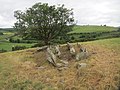 Enclosure in LackenavornaEnclosure · 482 yd
 Enclosure in Lackenavorna,tiermoyleEnclosure · 763 yd
 Moat of LatteraghCastle, motte · 1103 yd
 Killavalla WoodForest · 1385 yd
 Knockacraheen HillMountain / peak · 1471 yd
 Interragh HillMountain / peak · 1760 yd
 Latteragh Castle (in ruins)Castle, Anglo-Norman masonry castle · 1.2 mi
 Latteragh Housefarmyard complex · 1.3 mi
 Latteragh Church (in Ruins), Grave YardChurch · 1.3 mi
 Kyleroe WoodWood · 4.4 mi
 James Devaney MemorialMemorial · 6.8 mi
 Silvermines ViewpointViewpoint · 6.9 mi