What is recorded here
Situated on a rise, in pasture, with good views in all directions. Ringfort (WM024-100----) lies c. 30m to SE. Monument described as a large subcircular-shaped area enclosed by an earth and stone bank, a wide deep fosse and an outer bank that is incorporated into a field boundary from W-N and has drystone masonry facing along its interior. A bank on the exterior of the outer bank at S may be part of an old field system. There is a well-defined entrance in the inner bank (Wth at top 4.8m; basal Wth 2.4m) and outer bank at SE. There is a causeway (overall Wth 6.9m; Wth at top 4.1m; H 1m) at SE and a low bank (overall Wth 0.8m; Wth at top 0.4m; H 0.25m) defines the NE side of the causeway. The interior has a NW-facing slope and contains a complex of house sites and enclosures (WM024-099001-), low dividing banks and depressions. A Preservation Order was placed on this monument on 04/05/1984 (SMR file).
See attached plan and profile of monument surveyed and drawn by the ASI.
Compiled by Alison McQueen, Vera Rahilly and Caimin O’Brien.
Date of upload: 21 August 2019
The monument record does not grant public access. Check the route and ask the landowner before entering private land.
- What survives
- Recorded monument
Places near here
 Partially hachuredFairy fort / earthen ringfort · 356 yd
 Killeenbrack CastleCastle · 468 yd
 Killare ChurchChurch · 1404 yd
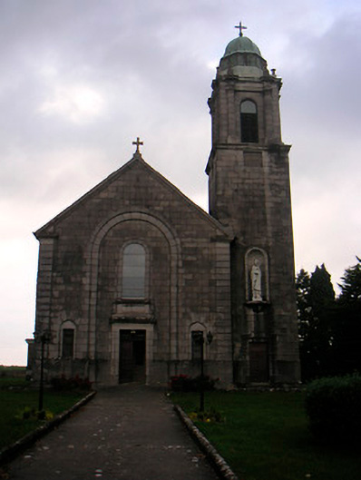 Saint Brigid's Catholic Churchchurch/chapel · 1435 yd
 OutlinedFairy fort / ringfort · 1449 yd
 European ashEuropean ash · 1493 yd
 Bawn in KillarecastleBawn · 1752 yd
 Sam's ParkForest · 1.2 mi
 Hill of UisneachMountain / peak · 1.6 mi
 KnockastiaMountain / peak · 2.9 mi
 Craft WorkshopHeritage attraction · 7.6 mi
 Guest ServicesVisitor information · 7.6 mi