What is recorded here
Killagh Beg holds a quarried ringfort where a graveyard still occupies the centre and a nettle-filled hollow hints at a hidden passage. The western bank has surrendered much of its stone to human taking, yet the eastern scarp and northern line remain visible on the grassy rise. People may have built, buried and forgotten the place across centuries, shaping it into a fairy fort through loss rather than invention.
On a rise in undulating grassland. Poorly preserved subcircular ringfort (N-S 48.1m, E-W 45.6m) defined by a stone-lined bank from N to E, and by a scarp from ESE to SSW. A gap at NE appears modern. The W half of the monument has been extensively quarried, and a field wall cuts it at SSW and SE. The interior contains a graveyard (GA086-157002-). There is also a possible Man-made underground passage, in NW quadrant, indicated by a rectangular nettle-filled hollow (L 10.1m, Wth c. 2.5m) running NNW-SS and averaging 0.7m in depth.
The above description is derived from the published 'Archaeological Inventory of County Galway Vol. II - North Galway'. Compiled by Olive Alcock, Kathy de hÓra and Paul Gosling (Dublin: Stationery Office, 1999).
Date of upload: 05 August 2010
The monument record does not grant public access. Check the route and ask the landowner before entering private land.
- What survives
- Recorded monument
Places near here
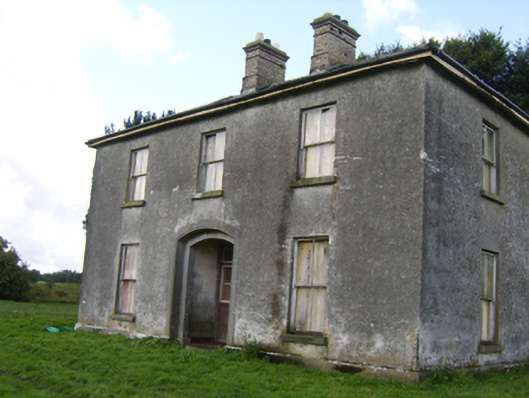 Killaghbeg Househouse · 250 yd
 Enclosure in CorraneenaEnclosure · 947 yd
 IndicatedKiln, lime · 1028 yd
 Enclosure in Killagh MoreEnclosure · 1120 yd
 CastleCastle, unclassified · 1.2 mi
 Site of Lisnamoltaun CastleCastle, unclassified · 1.4 mi
 Kilconnell AbbeyHeritage attraction · 1.7 mi
 Large-leaved LimeLarge-leaved Lime · 2.4 mi
 Western RedcedarWestern Redcedar · 3.0 mi
 Battle of Aughrim Interpretative CentreMuseum · 4.2 mi
 Battle of AughrimMajor battlefield · 4.5 mi
 The bloody HollowHeritage attraction · 4.8 mi