What is recorded here
No visible entrance, no central hollow, no boundary marker. The fort is a hidden room in the hill, waiting for the right person to stop asking questions and listen. The nearby fort and the lost field line suggest two lives sharing one ridge before human tools cut the connection.
In pasture, on gentle W-facing slope below top of steep-sided hill. Sub-circular area (22.1m N-S; 22.4m E-W) enclosed by earthen bank with external fosse (Wth 2m; D 0.15m) ENE->NW; enclosing element truncated by E-W field boundary NW->ENE. Bank (int. H 0.7m; ext. H 1.55m), best preserved SSE->S, has gaps at SSW (Wth 2.5m) and WSW (Wth 1.05m). Fosse, best preserved ENE->SSE, shallows SSE->S before fading out entirely SW->W. Interior, under rough pasture, slopes gently down to S. Another ringfort (LI019-18602-) lies immediately to NE and was probably conjoined to this enclosure before construction of field boundary between them.
Compiled by: Denis Power
Date of upload: 26 August 2011
The monument record does not grant public access. Check the route and ask the landowner before entering private land.
- What survives
- Recorded monument
Places near here
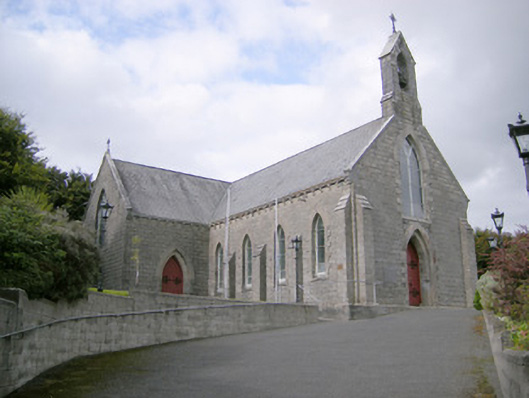 Saint Colman's Catholic Churchchurch/chapel · 167 yd
 Kilcolman Church (in ruins)Church · 243 yd
 Mound in KnockbweeheenMound · 637 yd
 Mound in Corbally (shanid By.)Mound · 965 yd
 Castle (in ruins)Castle, tower house · 1.3 mi
 Shanid CastleCastle · 1.8 mi
 St. Luke's WellSpring · 2.4 mi
 St. Kieran's WellSpring · 3.7 mi
 Monterey CypressMonterey Cypress · 5.6 mi
 Gammarel PointHeadland · 5.8 mi
 Limerick GreenwayWalking route · 5.9 mi
 Askeaton CastleHeritage attraction · 6.5 mi