What is recorded here
Kilcloony holds a 57-metre earthen ringfort on a sunny slope, marked by two fading banks and a narrow ditch. It sits beside older field lines and near Kilcloony Castle, suggesting a settled place rather than a temporary camp. The name “fairy fort” may reflect local wonder at its abandoned shape, but the earthworks point to human hands, tools and daily life.
In pastureland on a S-facing slope, some 150m to the WNW of a Kilcloony Castle (GA016-062001-). This poorly preserved circular rath (D 57m) is defined by two banks and an intervening fosse. The inner bank (Wth 4.5m; int. H 0.2m; ext. H 0.9m) is only visible at N and SW; elsewhere a scarp forms the enclosing element. The fosse (Wth 2.8m) and outer bank (Wth 2m; int. H 0.2m; ext. H 0.55m) survive all round except at SE or NW. FitzPatrick (2019, 24) noted field boundaries, on LiDAR imagery, extending off the rath at S, SW and NW. Segments of further curving field banks were also visible on the imagery in the field further to the N and S of the rath, and also in the field adjoining it to the E (see GA016-062002-). They may be part of a field system (GA016-064001-) associated with the rath. (CUCAP ATF 57; Alcock et al. 1999, 114)
Compiled by: Olive Alcock
Date of upload: 7 December 2022
The monument record does not grant public access. Check the route and ask the landowner before entering private land.
- What survives
- Recorded monument
Places near here
 Bawn in Kilcloony (dunmore By.)Bawn · 200 yd
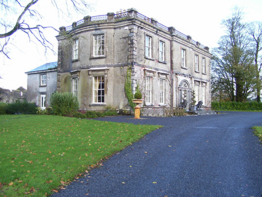 Quarrymount Househouse · 529 yd
 Cross in Kilcloony (dunmore By.)Cross · 697 yd
 Enclosure in Kilcloony (clonmacnowen By.),quarrymountEnclosure · 748 yd
 IndicatedHouse, indeterminate date · 1.2 mi
 Fartamore Castle in ruinsCastle, tower house · 2.1 mi
 European ashEuropean ash · 3.7 mi
 Mass RockNamed rock · 5.2 mi
 KnockmaaWood · 8.6 mi
 Otter IslandIslet · 17 mi
 Oileán an AoilIsland · 17 mi
 Field system in Clashaganny (dunmore By.),kilphrasogaField system · 885 yd