What is recorded here
Keale South holds a thirty-metre earthen ring where human hands first shaped the soil. People forgot the fort, planted trees inside it, and turned memory into a wooden circle. The earth still rises beneath the roots, waiting for someone to notice what the village stopped seeing.
In pasture, on S-facing slope, on demesne of Keale House c. 100m to N of River Blackwater. Depicted as hachured circular enclosure (diam. c. 30m) bisected by NE-SW field boundary off-centre to SE on 1842 OS 6-inch map. Arc (C 21m) formed by earthen bank (int. H 0.4m; ext. H 1.3m) survives on SE side of field boundary. Bank planted with mature deciduous trees. Raised interior overgrown, with some tree stumps visible. May be fort recorded by Bowman (1934, 305) on Mrs Faber's land, which was 'levelled long since'. Appears to have been used as a tree ring.
The above description is derived from the published 'Archaeological Inventory of County Cork. Volume 4: North Cork' (Dublin: Stationery Office, 2000). In certain instances the entries have been revised and updated in the light of recent research.
Date of upload/revision: 14 January 2009
The monument record does not grant public access. Check the route and ask the landowner before entering private land.
- What survives
- Recorded monument
Places near here
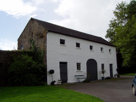 Keale Housefarmyard complex · 279 yd
 Fulacht fia in Drishane Beg (muskerry West By.)Fulacht fia · 1442 yd
 Flintfield Housecountry house · 1563 yd
 Burial ground in Killowen (muskerry West By.)Burial ground · 1711 yd
 Castle and TurretCastle, tower house · 1.4 mi
 Rathcool WoodWood · 1.7 mi
 Dromsicane Castle (in Ruins)Bawn · 1.8 mi
 Millstreet Tourist InformationVisitor information · 2.8 mi
 St. Patrick's ChurchVisitor information · 2.9 mi
 Millstreet Museum & Tourist Information CentreMuseum · 2.9 mi
 Battle of Knocknaclashybattle · 3.1 mi
 RowanRowan · 3.6 mi