What is recorded here
Fairy fort / earthen ringfort in Gortarowey is a fairy fort or earthen ringfort in Gortarowey, County Sligo, Ireland. It occupies a slight south-facing slope in low-lying wet pasture and contains a raised circular area nineteen metres across. A broad earthen bank three and a half metres wide and fifteen centimetres high surrounds the centre, while a shallow ditch three metres wide and fifteen centimetres deep cuts the outer base. Two gaps in the bank, one and a half metres and one metre wide, suggest possible entrance positions.
Situated on a slight S-facing slope in low-lying wet pasture. Slightly raised circular area (diam. 19m) enclosed by a low broad bank of earth (Wth 3.55m; int. H 0.15m). At the external base of the bank is a fosse (Wth 3m; D 0.15m). There breaks in the bank at NW (Wth 1.5m) and at ENE (Wth 1.05m), either of which could mark the position of the original entrance.
Compiled by: Patrick F. O'Donovan
Date of upload: 21 April 2011
The monument record does not grant public access. Check the route and ask the landowner before entering private land.
- What survives
- Recorded monument
Places near here
 Enclosure in GortaroweyEnclosure · 591 yd
 Urlar Househouse · 784 yd
 Tober PatrickArchaeological place · 810 yd
 Floods WoodForest · 1418 yd
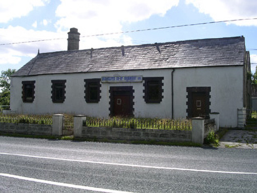 Drumcliffe Co-Operative Creamerycreamery · 1502 yd
 Castle (in Ruins)Castle, unclassified · 1682 yd
 Cat CornerWood · 1.2 mi
 CastleCastle, unclassified · 1.7 mi
 BenbulbinMountain / peak · 1.7 mi
 Grave of WB YeatsHeritage attraction · 1.9 mi
 Drumcliff CemeteryGraveyard · 1.9 mi
 Benbulbin South-East TopMountain / peak · 2.0 mi