What is recorded here
Fairy fort / earthen ringfort in Garrynamona is a fairy fort or earthen ringfort in Garrynamona, County Tipperary, Ireland. It occupies a steep southeast-facing slope beside rocky ground, where the southern half still shows a faint bank and a possible outer ditch. The northern half has no visible remains because the site was levelled, though map lines and an aerial photograph preserve the shape of the missing part.
Situated on a fairly steep SE-facing slope, off the summit of a hill, in an area of rock outcrop. Depicted as a circular enclosure on the 1st ed. (1843) and current (1952-3) OS 6-inch maps transected in the N sector by an E-W field boundary. On an aerial photograph taken in 1973 (GSIAP, S 465/6) only the enclosure S of the field boundary shows up clearly. The site has been levelled but the S half (dims. 20.3m N-S to field boundary wall; 25m E-W) could be discerned by a faint outline of a bank (Wth 3.6m; int. H 0.77m; ext. H 0.1m) and the suggestion of an outer fosse (Wth 3.5m; D 0.7m). No remains visible N of the field boundary.
The above description is derived from 'The Archaeological Inventory of County Tipperary. Vol. 1 - North Tipperary' compiled by Jean Farrelly and Caimin O'Brien (Dublin: Stationery Office, 2002). In certain instances the entries have been revised and updated in the light of recent research.
Date of upload/revision: 22 September 2008
The monument record does not grant public access. Check the route and ask the landowner before entering private land.
- What survives
- Recorded monument
Places near here
 Ecclesiastical enclosure in GarrynamonaEcclesiastical enclosure · 426 yd
 Edgeley Cottagehouse · 974 yd
 BallycahillSettlement deserted, medieval · 983 yd
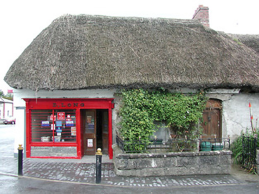 D. Longhouse · 986 yd
 Black Castle (in ruins)Castle, unclassified · 1704 yd
 Ballynahow CastleCastle · 1.1 mi
 Cormackstown Heritage CentreMuseum · 1.7 mi
 Pallas HillMountain / peak · 2.6 mi
 KnockaneMountain / peak · 2.7 mi
 European ashEuropean ash · 3.3 mi
 Lár na PáirceMuseum · 3.5 mi
 Wildlife CorridorWood · 3.9 mi