What is recorded here
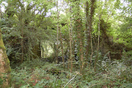
Fairy fort in Garranelahan: earthen ring, 45 metres across, on a steep south-facing slope in County Cork. A five-metre gap faces southeast, as if the circle waited for someone to enter rather than keep everyone out. The bank rises 1.3 metres, then thins and bends inward like a hand drawing back from a decision. People may have stood there in rain, heat, argument or love; the earth kept the shape while the names forgot the event.
In pasture, on steep S-facing slope. Circular area (45.5m N-S; 45.1m E-W) enclosed by earthen bank (H 1.3m) WNW->WSW. Gap in bank to SE (Wth 5m). Bank levelled to W for 26m, where low earthen bank (H 0.7m), running E-W for 20m, extends c.4.5m into interior.
The above description is derived from the published 'Archaeological Inventory of County Cork. Volume 1: West Cork' (Dublin: Stationery Office, 1992). In certain instances the entries have been revised and updated in the light of recent research.
Date of upload/revision: 14 January 2009
The monument record does not grant public access. Check the route and ask the landowner before entering private land.
- What survives
- Recorded monument
Places near here
 farm housefarm house · 979 yd
 BarrowBarrow, ring-barrow · 1628 yd
 bridgebridge · 1.0 mi
 IndicatedFairy fort / earthen ringfort · 1.0 mi
 Tobar MacloonaboySpring · 1.1 mi
 Castle DerryCastle · 2.4 mi
 Monteen Castle (in Ruins)Castle, tower house · 2.7 mi
 English hollyEnglish holly · 3.0 mi
 Graveyard in KilmalodaGraveyard · 3.0 mi
 The GlenWood · 3.3 mi
 Battle of the Big Cross (1798) Memorial MonumentMonument · 3.5 mi
 Corran HillMountain / peak · 3.9 mi