What is recorded here
Half a kilometre from the main road, a grass oval hides beneath a sloping bank. People called it a fairy fort because the gaps in the wall appear in more than one place, as though the fort refused a single front door. The small stream nearby and the broken earth suggest human hands shaped the area, yet the name preserves the older belief that some rooms belong elsewhere.
Located at the base of a NW-facing slope with a small canalized WSW-ENE stream c. 30m to the N. This is a grass-covered oval area (dims 26.5m E-W; 20.7m N-S) defined by an overgrown earth and stone bank (Wth 3-3.5m; int. H 0.7-1m; ext. H 1-1.6m) NE-S-SW, and by an overgrown scarp (H 1.2-1.4m) elsewhere. The entrance (Wth 3.2m) is at NE but there are gaps also in the bank at SSE (Wth 2.4m) and SSW (Wth 1.6m).
The above description is derived from 'The Archaeological Inventory of County Leitrim' compiled by Michael J. Moore (Dublin: Stationery Office, 2003). In certain instances the entries have been revised and updated in the light of recent research.
Date of upload: 23 September 2008
The monument record does not grant public access. Check the route and ask the landowner before entering private land.
- What survives
- Recorded monument
Places near here
 Fairy fort / stone ringfort in CleighranFairy fort / stone ringfort · 1404 yd
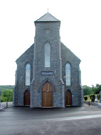 Saint Mary's Catholic Churchchurch/chapel · 1738 yd
 MoteCastle, motte · 1.0 mi
 Corn kilnSweathouse · 1.2 mi
 Church (in Ruins)Church · 1.3 mi
 CastleCastle, unclassified · 1.6 mi
 Cullentra ForestForest · 2.5 mi
 SlishwoodWood · 2.8 mi
 Trawane BayBay · 2.8 mi
 InnisfreeIslet · 2.9 mi
 Slishwood Island WestIslet · 3.5 mi
 Bunowen BayBay · 3.7 mi