What is recorded here
Half a metre of earth and four decades of forgetting make a fair fort, but the shape holds. A circle forty-four paces across, broken only where a cart lane cuts through, sits at the top of a ridge above Lough Allen. People called it a fairy fort because the middle was empty and the border would not explain itself. That much is true. What lives inside the line is still debate.
At the N end of a N-S drumlin ridge on the W shore of Lough Allen. Rush-covered subcircular area (dims. 44m N-S; 38m E-W) defined by an overgrown scarp (H 0.5-0.7m). There is a modern entrance (Wth 3m) at SE where the site is skirted by a NE-SW laneway.
The above description is derived from 'The Archaeological Inventory of County Leitrim' compiled by Michael J. Moore (Dublin: Stationery Office, 2003). In certain instances the entries have been revised and updated in the light of recent research.
Date of upload: 23 September 2008
The monument record does not grant public access. Check the route and ask the landowner before entering private land.
- What survives
- Recorded monument
Places near here
 European ashEuropean ash · 743 yd
 Corry IslandIslet · 796 yd
 Black PoplarBlack Poplar · 831 yd
 Scardan WaterfallWaterfall · 1673 yd
 Saint Patricks ChurchRuins · 1.5 mi
 Sweat Ho.Sweathouse · 1.5 mi
 Drummans IslandIslet · 1.5 mi
 Penal Mass station in Drummans LowerPenal Mass station · 1.8 mi
 Seltannasaggart SE SlopeMountain / peak · 2.0 mi
 CloughbannyMass-rock · 2.1 mi
 Forde's CastleCastle · 2.1 mi
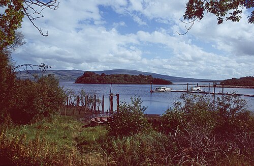 Lough AllenLarge freshwater lake · 3.2 mi