What is recorded here
Drumillard Big holds a hidden ringfort where a field bank curves across pasture at the northwestern edge of a drumlin ridge. The 1834 map drew a thirty-five metre fort in gothic lettering, but the 1907 map reduced the same place to an ordinary boundary line. Human hands may have built the circle before livestock and farming smoothed it into the landscape, leaving only a subtle bend in the earth to mark the forgotten fort.
Located the NW end of a NW-SE drumlin ridge. It is depicted as a circular embanked enclosure (ext. diam. c. 35m) on the 1834 edition of the OS 6-inch map where it is described in gothic lettering as a ‘fort’ and as a curve in a field bank SE-W on the 1907 edition. No archaeological feature is visible at ground level in pasture, but the bank is probably incorporated into a field bank and hedge SE-W-NW (diam. c. 35m
The above description is derived from the published 'Archaeological Inventory of County Monaghan' (Dublin: Stationery Office, 1986). In certain instances the entries have been revised and updated in the light of recent research.
Revised by: Michael Moore
Date of revision: 22 June 2018
The monument record does not grant public access. Check the route and ask the landowner before entering private land.
- What survives
- Recorded monument
Places near here
 First Castleblayney Presbyterian Churchchurch/chapel · 917 yd
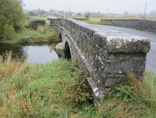 Derrycreevy Bridgebridge · 953 yd
 John Francis GreenMemorial · 975 yd
 The CrescentMemorial · 1277 yd
 Monaghan WayWalking route · 1699 yd
 Bawn in OnomyBawn · 1.1 mi
 Blaney CastleCastle · 1.1 mi
 Fulacht fia in GrigFulacht fia · 1.1 mi
 Harper's IslandIslet · 1.4 mi
 Garmany's IslandIslet · 1.5 mi
 Lough MucknoLake and park landscape · 1.7 mi
 Crannog in MoneyvolanCrannog · 1.8 mi