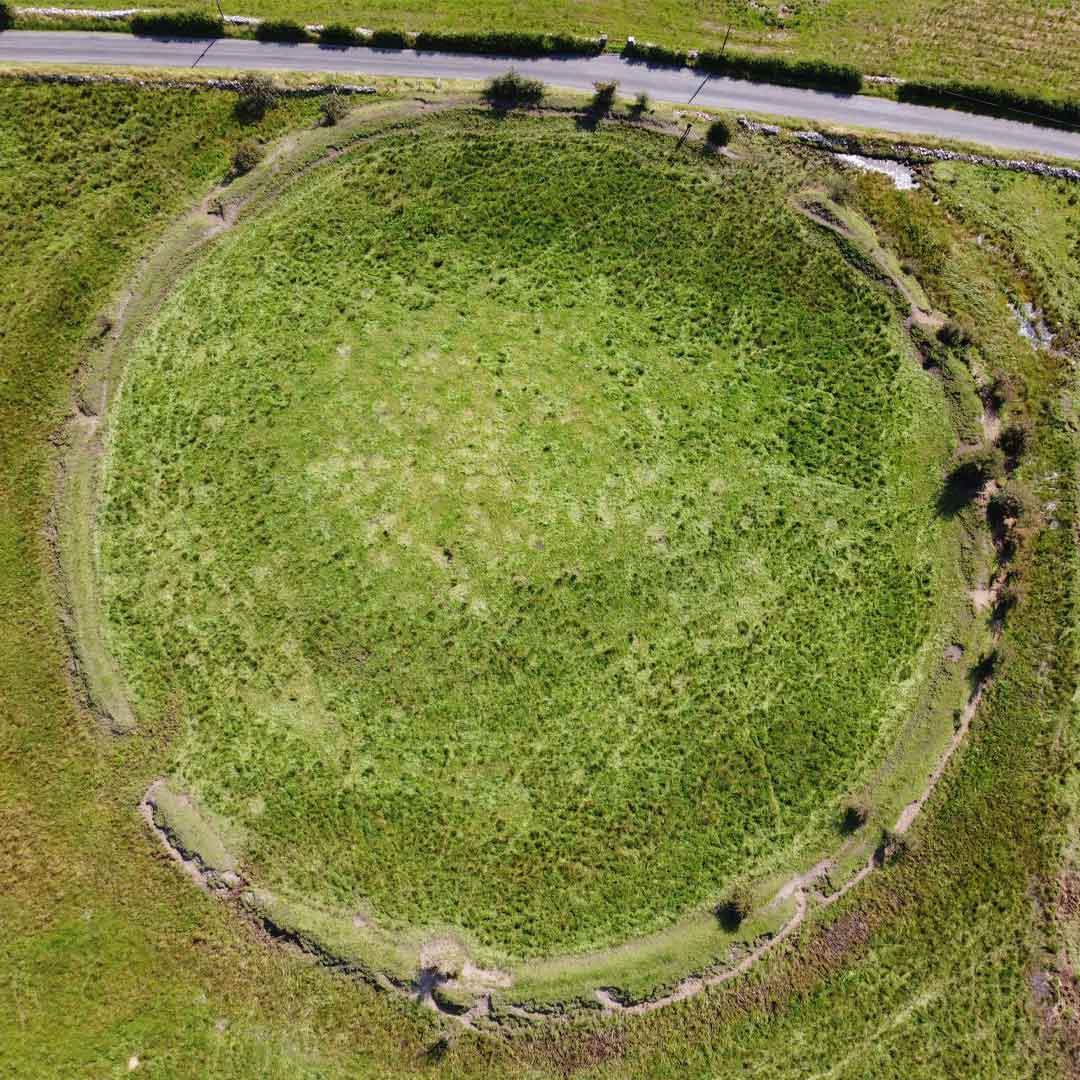
What is recorded here
From the National Monuments Service (Archaeological Survey of Ireland) record LE006-038
Places near here
Photo credits
- Maker not stated on source page, www.alamy.com
- Maker not stated on source page, www.pinterest.ca
- Maker not stated on source page, www.dreamstime.com
- Maker not stated on source page, www.findagrave.com
- Maker not stated on source page, tr.pinterest.com
- Michael Murtagh, Geograph · CC BY-SA 2.0
- Oliver Dixon, Geograph · CC BY-SA 2.0
- Dieglop, Wikimedia Commons · CC BY-SA 4.0
 Killenora GraveyardCemetery · 354 yd
Explorer Tom Killenora Graveyard would say in a job interview that it’s great at listening and terrible at multitasking. It’s…
 Diffreen CemeteryCemetery · 590 yd
Explorer Tom Diffreen Cemetery is obsessed with the opinion of the local sheep, who think the whole layout is a bit too serious for…
 Fairy fort / earthen ringfort in DrummahanFairy fort / earthen ringfort · 920 yd
Explorer Tom This Fairy fort in Drummahan has an imaginary twin across the sea who sends it postcards about the weather, which is…
 Fairy fort / earthen ringfort in SraneaFairy fort / earthen ringfort · 1438 yd
Explorer Tom This fairy fort in Sranea would write 'Likes long walks' on its dating profile. It’s got a proper entrance and…
 Mapped graveyardGraveyard · 1593 yd
Explorer Tom Mapped graveyard in County Leitrim smells like wet wool and ancient secrets if you really lean in. It’s got a scent…
 Megalithic structure in LugnafaugheryMegalithic structure · 1663 yd
Explorer Tom Megalithic structure in Lugnafaughery would cope on a reality show by standing still while everyone else argues. It’s…
 Holy well in Aghamore (rosclogher By., Glencar Ed)Holy well · 1.5 mi
Explorer Tom Holy well in Aghamore is so lost, even St Patrick can’t find it. I swear it smells like old socks and regret, but maybe…
Fairy fort / earthen ringfort in CarrickeenyFairy fort / earthen ringfort · 1.6 miExplorer Tom Fairy fort / earthen ringfort in Carrickeeny wins the county fair for best looking grassy oval. It doesn’t need a gate…
 Keelogyboy Mountain ne TopMountain / peak · 1.6 mi
Explorer Tom Keelogyboy Mountain NE Top has been hiding a scandal involving a missing chalice for centuries, and it's getting quite…
 CrockaunsMountain / peak · 1.8 mi
Explorer Tom Crockauns bragged about surviving a storm so violent it rearranged its own topography and sent the local cows into a…
 Glencar IslandIslet · 1.9 mi
Explorer Tom Glencar Island in County Leitrim would complain to the council about the noise levels from the swans, claiming they’re…
 Glencar WaterfallVisitor information · 2.0 mi
Explorer Tom Glencar Waterfall in County Leitrim gave up sugar for Lent but ended up eating a whole wheel of cheese instead anyway.…
More archaeology and monuments in County Leitrim · All of County Leitrim

What do you know about this place?Tap to add a comment or ask a question