What is recorded here
Fairy fort in Curraleigh, County Cork: an earthen ringfort in tillage on a south-facing slope, drawn as an oval enclosure about forty metres long on the 1842 Ordnance Survey map. The southern bank may be building rubble from a nearby farm rather than an ancient defence, yet the name and hidden passage in the north-east quadrant suggest people once saw the place as more than a boundary.
In tillage, on S-facing slope. Depicted as hachured oval enclosure (diam. c. 40m N-S; c. 35m E-W) on 1842 OS 6-inch map. Circular raised area (diam. 24m) defined by scarp (H 0.2m). According to local information, material dumped on S edge of site, giving appearance of a bank, is from construction of farm building to S of monument. Possible Man-made underground passage (CO073-092----) in NE quadrant.
The above description is derived from the published 'Archaeological Inventory of County Cork. Volume 3: Mid Cork' (Dublin: Stationery Office, 1997). In certain instances the entries have been revised and updated in the light of recent research.
Date of upload/revision: 14 January 2009
The monument record does not grant public access. Check the route and ask the landowner before entering private land.
- What survives
- Recorded monument
Places near here
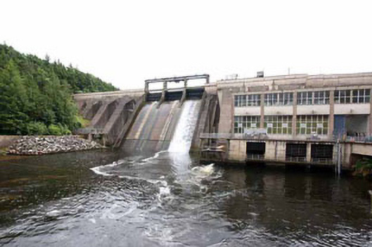 Inniscarra Hydro Electric Power Stationdam/reservoir/basin · 611 yd
 Castle Inch (in Ruins)Castle, tower house · 1039 yd
 Designed landscape feature in ArdrumDesigned landscape feature · 1121 yd
 Flooded buildingsRuins · 1189 yd
 Iniscarra Dam ViewViewpoint · 1340 yd
 Bob AdamsMemorial · 1485 yd
 Marys Well, Sundays WellHoly well · 1707 yd
 Ballyanly Inniscarra Slí na SláinteWalking route · 1.5 mi
 Hugh MaguireMemorial · 1.6 mi
 Grange HillMountain / peak · 3.1 mi
 Ballincollig CastleCastle · 3.3 mi
 Cave in Ballincollig (muskerry East By., Carrigrohane Par.)Cave · 3.3 mi