What is recorded here
Situated on top of a natural rise, in gently undulating pasture with good views to E, S, W and NW and overlooked by higher ground to N and NNE. Depicted on the revised 1913 ed. OS 6-inch map as an irregular-shaped earthwork. Monument described in 1970 as a much disturbed subcircular-shaped area (approx. dims. 30m NW-SE; 26m NE-SW) enclosed by a bank. The bank is steep on the exterior and is best preserved from E-SSE and from W-WNW. The original entrance is not recognisable. A hole has been quarried into the perimeter at S. A modern curvilinear bank with a modern trench on its interior has been made against the inner face of the bank from S-WSW and has been straightened at WSW where it traverses the exterior of the bank. There is a wide shallow depression at the foot of the scarp from WSW-W-NNW which may represent a partly silted fosse, however it connects to the trench mentioned and may be modern. The perimeter is also disturbed from NNW-N-ENE where it is replaced by a modern field bank. A steep modern field fence running N-S intersects the bank at ESE. The interior has a gentle NW-facing slope and a roughly circular depression (approx. diam. 4.5m) near the centre. Monument is visible on Digital Globe aerial photography as a roughly oval-shaped tree-covered earthwork.
Compiled by: Alison McQueen, Vera Rahilly and Caimin O’Brien
Date of upload: 04 June 2019
The monument record does not grant public access. Check the route and ask the landowner before entering private land.
- What survives
- Recorded monument
Places near here
 Partially hachuredFairy fort / earthen ringfort · 645 yd
 Ecclesiastical enclosure in RathconnellEcclesiastical enclosure · 1284 yd
 Church (in Ruins)Church · 1296 yd
 Site of CastleCastle, unclassified · 1400 yd
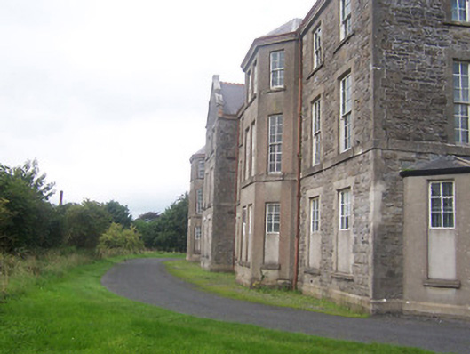 hospital/infirmaryhospital/infirmary · 1736 yd
 Boardstown Castle (in Ruins)Castle, tower house · 1.8 mi
 Augustinian Monks Memorial StatueMemorial · 1.9 mi
 United Nations War MemorialMemorial · 2.4 mi
 Saint Brigid's WellSpring · 2.7 mi
 Long PlantingForest · 2.9 mi
 Lady's IslandWood · 3.8 mi
 Church IslandIsland · 4.1 mi