What is recorded here
Fairy fort in Creevy, County Donegal: a 15.5m earthen ring on rough grazing north of the River Erne, its west gap perhaps the entrance and faint foundation marks suggesting small structures inside. People may have lived there, herded there, or simply avoided the rough uneven ground after dark. The earth still holds the shape of a choice made long before paperwork.
Internal diam. 15.5m. A subcircular space enclosed by a bank of earth and stone. The bank survives to a height of .5m in the N sector but is slightly higher in the S. A gap in the W may be the original entrance. There are very slight traces of a silted-up fosse particularly on the S side. The interior is very rough and uneven. Traces of foundations in the W sector could be remains of structures. It is situated on rough-grazing land N of the River Erne.
The above description was derived from the 'Archaeological Survey of County Donegal. A description of the field antiquities of the County from the Mesolithic Period to the 17th century.' Compiled by: Brian Lacey with Eamon Cody, Claire Cotter, Judy Cuppage, Noel Dunne, Vincent Hurley, Celie O'Rahilly, Paul Walsh and Seán Ó Nualláin (Lifford: Donegal County Council, 1983). In certain instances the entries have been revised and updated.
Date of upload: 22 September 2008
The monument record does not grant public access. Check the route and ask the landowner before entering private land.
- What survives
- Recorded monument
Places near here
 bridgebridge · 299 yd
 Creevy Stone Ringfort and Man-made underground passage near KilbarronFairy fort / stone ringfort · 589 yd
 Ballymacaward Eastern Fairy FortFairy fort / earthen ringfort · 593 yd
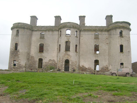 Wardstown Housecountry house · 1271 yd
 Kilbarron Old Church GraveyardGraveyard · 1287 yd
 Dark Cliffs at KilbarronPublicly named cliff or headland · 1.1 mi
 Kilbarron Castle in ruinsCastle, tower house · 1.1 mi
 Wardtown StrandBeach / strand · 1.2 mi
 Tullan StrandBeach / strand · 1.7 mi
 St Anne's Church GraveyardGraveyard · 2.0 mi
 RossnowlaghOfficial bathing water · 2.2 mi
 CastleCastle, unclassified · 2.2 mi