What is recorded here
Fairy fort in Corrspark, County Galway: a shallow ring, thirty metres across, half eaten by grass and field banks. What remains is a low bank and ditch, visible at the north and south, the rest reduced to a scarp. The shape still reads as a made place, not a mound of chance. People may have lived there, marked it, or simply walked past it after the wall collapsed. The fort has lost its sharp edge but not its claim to be seen.
On a rise in grassland. Poorly preserved subcircular rath (N-S 30m, E-W 28m) defined by a denuded bank and external fosse, both of which survive at N and from SE through S to SW. A scarp forms the enclosing element elsewhere. A field bank cuts the monument at NNE and SW.
The above description is derived from the published 'Archaeological Inventory of County Galway Vol. II - North Galway'. Compiled by Olive Alcock, Kathy de hÓra and Paul Gosling (Dublin: Stationery Office, 1999).
Date of upload: 05 August 2010
The monument record does not grant public access. Check the route and ask the landowner before entering private land.
- What survives
- Recorded monument
Places near here
 Kilmacanganyn Church (Site of)Church · 555 yd
 Site of Killomaine Grave YardArchaeological place · 577 yd
 Cross (present location) in KeelogesbegCross (present location) · 686 yd
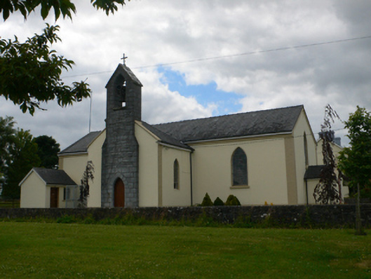 Saint Michael's Catholic Churchchurch/chapel · 694 yd
 Corn KilnsKiln, corn-drying · 806 yd
_-_geograph.org.uk_-_1952978.jpg?width=1280) Bawn in Glinsk (ballymoe By.)Bawn · 1432 yd
Bawn in Glinsk (ballymoe By.)Bawn · 1432 yd Site of Ballyglass CastleCastle, unclassified · 2.8 mi
 Rook HillMountain / peak · 3.7 mi
 HawthornHawthorn · 4.5 mi
 Mount MaryMountain / peak · 6.6 mi
 European ashEuropean ash · 7.0 mi
 Sally IslandIslet · 7.9 mi