What is recorded here
Fairy fort, Corcamore: a broken ring of earth and stone on a sunny slope, partly buried under field stones and memory. Inside the shallow bank, the ground still rises and falls like a breath held too long. People may have lived there before forgetting, or the fairies may have taken the shape back when the walls thinned. Either way, the circle remains visible in grass and shadow, waiting for someone to stop measuring and listen.
In pasture, on slight SSE-facing slope of rising ground, 200m W of the townland boundary with Carrigogunnel. Present remains consist of a raised roughly circular-shaped area (approx. diam. 30m) enclosed by a poorly preserved earth and stone bank (int. H 0.4m; ext. H 0.8m; base Wth 4m). The enclosing element has been disturbed by the dumping of field clearance stones. The undulating rocky interior has also been partially infilled with field clearance material. A field boundary running N-S intersects the base of the bank at W. Poorly preserved monument visible on Google Earth orthoimage taken 2019 as a circular-shaped area enclosed by a low bank reduced to a scarp from SE through S to W, overgrown with trees elsewhere.
See attached Google Earth orthoimages taken 28/06/2018 and 19/11/2019
Compiled by: Martin Fitzpatrick
Date upload: 18 June 2020
The monument record does not grant public access. Check the route and ask the landowner before entering private land.
- What survives
- Recorded monument
Places near here
 CloughregaunMegalithic structure · 899 yd
 Carrigogunnell CastleRuins · 1007 yd
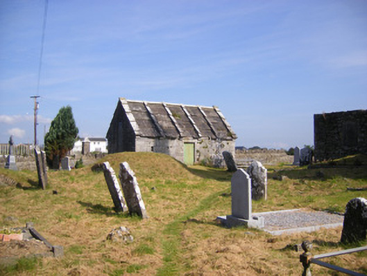 Church of Saint Philip and Saint James (Kilkeedy)mausoleum · 1221 yd
 Grave YardGraveyard · 1254 yd
 kilnkiln · 1347 yd
 Meelick Ho.House, fortified house · 1537 yd
 St James's WellSpring · 1.1 mi
 Sailors HaggardMemorial · 1.5 mi
 Muckinish PointHeadland · 2.4 mi
 Grass IslandIslet · 3.1 mi
 Maiden RockNamed rock · 3.3 mi
 Cratloe WoodsForest · 4.4 mi