What is recorded here
Fairy forts are earthen rings built by humans, often lost to ploughs or forgotten in pasture. In Codrum, one sat on a south-facing slope above the Sullane River valley. Local information says it was levelled about ten years ago, leaving only low undulations in the grass. The river valley still holds the shape of the place, even when the fort itself has vanished from sight.
In pasture, on S-facing slope, overlooking Sullane River valley. According to local information, 'fort' levelled c. 10 years ago. Low undulations visible in area of site.
See Excavations 1997, no. 35, p. 9-10
The above description is derived from the published 'Archaeological Inventory of County Cork. Volume 3: Mid Cork' (Dublin: Stationery Office, 1997). In certain instances the entries have been revised and updated in the light of recent research.
Date of upload/revision: 14 January 2009
A fairy fort or earthen ringfort in Codrum, likely dating to the early medieval period, is situated on a south-facing slope overlooking the Sullane River valley. Local tradition associates the site with fairy lore, while archaeological references from 1997 note its partial destruction and visible low undulations.
The monument record does not grant public access. Check the route and ask the landowner before entering private land.
- What survives
- Recorded monument
Places near here
 IndicatedFairy fort / earthen ringfort · 214 yd
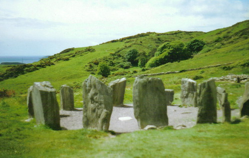 St Gobnets StoneRitual site, holy/saint's stone · 284 yd
 Codrumcountry house · 630 yd
 bridgebridge · 886 yd
 Curraheen WoodWood · 1.0 mi
 Macroom WalksVisitor information · 1.3 mi
 Macroom Castle (in Ruins)Castle, tower house · 1.3 mi
 Neill's WoodWood · 1.4 mi
 Dundareirke Castle (in Ruins)Castle, tower house · 1.5 mi
 Battle of Macroombattle · 1.5 mi
 Clonavrick CliffCliff · 3.5 mi
 Priest MemorialMemorial · 6.1 mi