What is recorded here
Fairy fort in Clouracaun: an earthen ringfort, oval 48 by 39 metres, with a 1.8-metre bank on a south-facing slope in County Cork. It is not a distant monument but a lived edge of the field, its ridge continuing the fence line and marking where human hands shaped the land. People may have stood inside it, watched the valley, or kept something back from the open slope. The fort still holds that shape, waiting to be remembered.
In tillage, on S-facing slope. Oval area (39.5m N-S; 48m E-W) defined by earthen bank (H 1.8m) NE->SE forming part of field fence system; soilmark forming low arc SE->NE.
The above description is derived from the published 'Archaeological Inventory of County Cork. Volume 2: East and South Cork' (Dublin: Stationery Office, 1994). In certain instances the entries have been revised and updated in the light of recent research.
Date of upload/revision: 14 January 2009
The monument record does not grant public access. Check the route and ask the landowner before entering private land.
- What survives
- Recorded monument
Places near here
 Farlistown Househouse · 1.1 mi
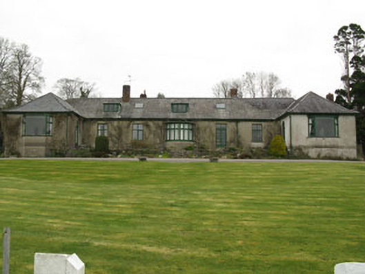 Shippool Housecountry house · 1.2 mi
 Grave YardGraveyard · 1.4 mi
 Shippool CastleCastle · 1.5 mi
 Killountane Burial Gd (Disused)Burial ground · 1.5 mi
 Shippool WoodWood · 1.7 mi
 Leighmoney Castle (Site of)Castle, unclassified · 1.9 mi
 Marie LouiseWreck · 2.3 mi
 Dromkeen Wood Nature ReserveForest · 2.5 mi
 The Stone of DestinyMemorial · 3.5 mi
 Graveyard in Abbey-Lands, Part of (kinsale By., Ringcurran Par.)Graveyard · 5.0 mi
 Blacks Brewery & DistilleryHeritage attraction · 5.1 mi