What is recorded here
Fairy forts are often a human invention, a way of naming what we do not understand. This is a ringfort in County Limerick, an earthen circle set in pasture on a gentle slope, its bank still standing though reduced in places. People may have lived here, marked territory, kept fire or simply made a shape that could be remembered. The fairies come later, filling the gap between knowledge and wonder.
In pasture, on gentle W-facing slope below brow of low ridge. Roughly circular area (37.4m N-S; 35.6m E-W) enclosed by earthen bank SW->E, with shallow external fosse (Wth 3m; D 0.2m) NNE->SW. Enclosure is defined by a field boundary (H 1.35m) E->SW. Bank (int. H 0.4m; ext. H 1.05m), best preserved SW->W, has been partially removed at WNW where a depression extends into interior for c. 8.4m. Interior surface is uneven and covered by tall grass; roughly circular depression (0.9m N-S x 1.4m E-W; D 0.35m) immediately to N of centre.
Compiled by: Denis Power
Date of upload: 26 August 2011
The monument record does not grant public access. Check the route and ask the landowner before entering private land.
- What survives
- Recorded monument
Places near here
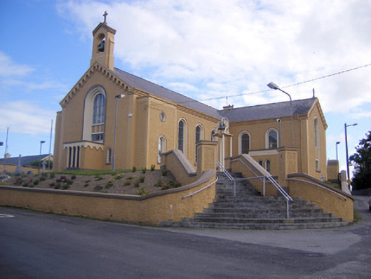 Saint Senan's Catholic Churchchurch/chapel · 495 yd
 Elm Villehouse · 814 yd
 Holy well in Shanagolden DemesneHoly well · 1437 yd
 Enclosure in ParkmoreEnclosure · 1487 yd
 Site of CastleCastle, unclassified · 1.2 mi
 Castle (Site of)Castle, unclassified · 1.2 mi
 Foynes Flying Boat & Maritime MuseumMuseum · 3.3 mi
 Foynes Island ViewpointViewpoint · 3.5 mi
 Gammarel PointHeadland · 3.7 mi
 Monterey CypressMonterey Cypress · 3.8 mi
 Foynes IslandIsland · 4.0 mi
 Battery PointHeadland · 4.2 mi