What is recorded here
Mortons and others still call it a fairy fort because the flat grassy circle sits on a NW-facing slope above marshy land, not because anyone proved it fairy-owned. The earthen bank stands 0.8m high inside and 0.4m outside, with a taller 1.2m scarp to the northwest and a slight depression at the centre. A true ringfort lies about 150m to the southeast, so the smaller circle may have been a boundary, a shrine, a child-play ring or a forgotten house reduced to a shallow dish.
In pasture, on NW-facing slope down to nearby stretch of low flat marshy land. Roughly circular area (24m N-S; 20m E-W) enclosed by low, worn, earthen bank (int. H 0.8m; ext. H 0.4m), except to NW where scarp (H 1.2m) exists. Interior grass-covered; slight depression at centre. Ringfort (CO039-039---) lies c. 150m to SE.
The above description is derived from the published 'Archaeological Inventory of County Cork. Volume 4: North Cork' (Dublin: Stationery Office, 2000). In certain instances the entries have been revised and updated in the light of recent research.
Date of upload/revision: 14 January 2009
The monument record does not grant public access. Check the route and ask the landowner before entering private land.
- What survives
- Recorded monument
Places near here
 IndicatedFairy fort / earthen ringfort · 1324 yd
 TubridHoly well · 1384 yd
 Inchileigh Bridgebridge · 1.2 mi
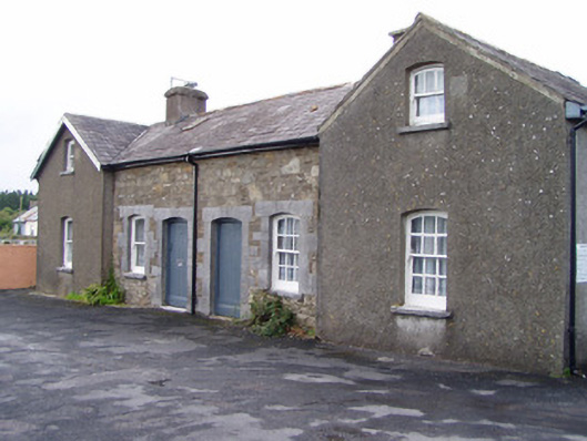 Millstreet Railway Stationworker's house · 1.2 mi
 Claragh MountainMountain / peak · 1.4 mi
 Millstreet Museum & Tourist Information CentreMuseum · 1.4 mi
 Claragh Loop (Trailhead 99)Visitor information · 1.5 mi
 St. Patrick's ChurchVisitor information · 1.5 mi
 Dromsicane Castle (in Ruins)Bawn · 1.8 mi
 RowanRowan · 2.0 mi
 Castle and TurretCastle, tower house · 2.2 mi
 CurracahillMountain / peak · 2.8 mi