What is recorded here
Ceathrúin An Phúca holds a vanished ringfort, now reduced to a shallow ridge barely half a metre high. Maps and memories disagree about its shape, size and even its exact position, while local story speaks of a red cave cutting through the earth beneath it. The ground has erased the wall, but it has not erased the idea that people once lived inside a circle marked by red stone and shadow.
This site is now marked only by a slight eminence which measures 12m NE-SW x 20m NW-SE x less than .5m in height. It was marked on the 2nd edition of the OS map as a rectangular enclosure with a Man-made underground passage, known as the Red Cave, at its NW corner. On the 1st edition of the OS map the site was depicted as a univallate circular enclosure and was marked about 150m N of the present remains. It was described in the OSNB (Kildrum, 36) as a circular fort about 1.5 chains (30m) in diameter and 2 feet (.6m) high with the entrance to the Man-made underground passage located at its centre. The latter was said to link up with another ringfort on the S boundary of the townland (KE053-001----).
The above description is derived from J. Cuppage, ‘Corca Dhuibhne. Dingle Peninsula archaeological survey. Ballyferriter. Oidhreacht Chorca Dhuibhne’ (1986), no. 651. In certain instances the entries have been revised and updated in the light of recent research.
Date of upload: 7 August 2013
The monument record does not grant public access. Check the route and ask the landowner before entering private land.
- What survives
- Recorded monument
Places near here
 Man-made underground passage in Ceathrúin An PhúcaMan-made underground passage · 10 yd
 Enclosure in Ceathrúin An Phúca,móin An FhraoighEnclosure · 330 yd
 An Chathair AirdMountain / peak · 1445 yd
 Templemanaghan (Oratory)Church · 1.2 mi
 Site of Ballingolin CastleArchaeological place · 1.2 mi
 CastleCastle, unclassified · 1.2 mi
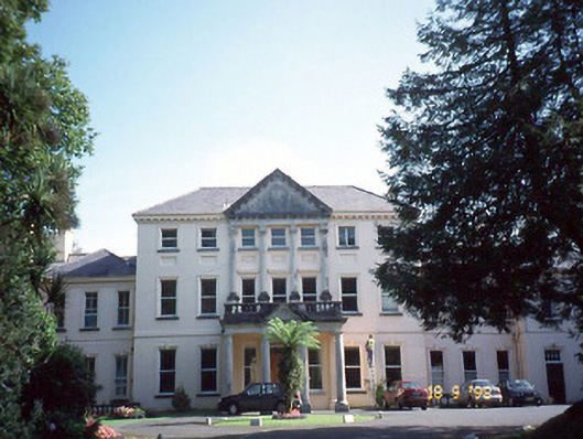 Coláiste Ídecountry house · 1.3 mi
 Binn BreacMountain / peak · 1.6 mi
 Trá Ciarán BeachBeach / strand · 2.0 mi
 Dingle Marina Dive CentreHeritage attraction · 2.3 mi
 Memorial to all who lost their lives in our seas.Memorial · 2.4 mi
 Charles HaugheyMemorial · 2.4 mi