Places near here
Photo credits
- Ridiculopathy, Wikimedia Commons · CC0
- Seandálaí, Wikimedia Commons · CC BY-SA 4.0
- Nigel Cox, Wikimedia Commons · CC BY-SA 2.0
- Mucklagh, Wikimedia Commons · CC BY-SA 4.0
- Ingo Mehling, Wikimedia Commons · CC BY-SA 3.0
- Boston at English Wikipedia, Wikimedia Commons · Public domain
- David Dixon, Geograph · CC BY-SA 2.0
- Pampuco, Wikimedia Commons · CC BY-SA 4.0
- Warrenfish, Wikimedia Commons · CC BY-SA 3.0
- Bjørn Christian Tørrissen, Wikimedia Commons · CC BY-SA 3.0
 OutlinedEcclesiastical enclosure · 669 yd
Explorer Tom Ecclesiastical enclosure in Mám An Óraigh claims to be a shortcut to heaven, but it’s mostly just mud and graves. It’s been a burial ground since before your grandad knew how to tie shoelaces. Find a local and ask them the real story, then come back and tell me.
 Templemanaghan (Oratory)Church · 1.2 mi
 Rahinnane Castle (in ruins)Castle, tower house · 1.4 mi
Explorer Tom Rahinnane Castle would ace a job interview by listing its surviving turret as a key asset. The eastern sector is just footings now, which is a bit of an awkward topic. Stop the car, it's worth the hazard lights.
 Séipéal Chaitlín Naofa [Saint Catherine's Catholic Church]Church/chapel · 1.5 mi
 Grave YardGraveyard · 1.8 mi
Explorer Tom Graveyard in Fionntrá has been the subject of priestly disputes since the fourteenth century, which is just fancy talk for arguing over property lines. Smugglers probably hid their gold right under those ancient stones. Make a wish, it's had centuries of practice.
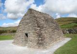 Gallarus OratoryHeritage attraction · 2.2 mi
 Riasc Monastic SettlementHeritage attraction · 2.4 mi
 Gallarus CastleCastle · 2.4 mi
 Charles HaugheyMemorial · 3.2 mi
 Cnoc na CeathrúnMountain / peak · 3.4 mi
 Eask TowerViewpoint · 3.4 mi
 Sliabh an IolairMountain / peak · 3.8 mi
More mountains and hills in County Kerry · All of County Kerry

What do you know about this place?Tap to add a comment or ask a question