What is recorded here
Fairy fort / earthen ringfort in Ballynahow (Ballycahill parish) is a fairy fort or earthen ringfort in Ballynahow (Ballycahill parish), County Tipperary, Ireland. The circular site measures 40 metres north-south and 36.5 metres east-west on the northeast-facing slope of a hill just below the summit. An earth and stone bank, 1.3 metres wide with an internal height of 0.56 metres and an external height of 0.87 metres, defines the enclosure, though no outer ditch is visible. A six-metre break downslope in the northwest quadrant may be the remains of an original entrance, though it has been widened.
Located on the NE-facing slope of a hill, just off the summit in rolling terrain. A circular site (diam. 40m N-S; 36.5m E-W) defined by an earth and stone bank (Wth 1.3m; int. H 0.56m; ext. H 0.87m) with no outer fosse visible. Some outcrop protrudes in the interior. A break in the bank downslope in the NW quadrant (Wth 6m) may be remains of an original entrance, though widened. An oval mound of stones (dims. 7.1m x 5m; H 0.5m), grassed over, near the centre of the interior, appears to be dumped field clearance material. A concrete post and pail fence transects the SW quadrant on a NW-SE axis. The bank in the E sector has been destroyed by limited quarrying which extended slightly into the interior and occupies the immediate area outside the bank.
The above description is derived from 'The Archaeological Inventory of County Tipperary. Vol. 1 - North Tipperary' compiled by Jean Farrelly and Caimin O'Brien (Dublin: Stationery Office, 2002). In certain instances the entries have been revised and updated in the light of recent research.
Date of upload/revision: 22 September 2008
This remains an important historical record, but the official description says the monument is no longer visible or has been destroyed. The monument record does not grant public access. Check the route and ask the landowner before entering private land.
- What survives
- No visible remains or recorded as destroyed
Places near here
 Ballynahow CastleCastle · 685 yd
 BallycahillSettlement deserted, medieval · 1418 yd
 Edgeley Cottagehouse · 1457 yd
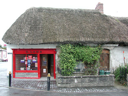 D. Longhouse · 1482 yd
 Ecclesiastical enclosure in GarrynamonaEcclesiastical enclosure · 1515 yd
 Black Castle (in ruins)Castle, unclassified · 1.4 mi
 Cormackstown Heritage CentreMuseum · 2.0 mi
 Pallas HillMountain / peak · 2.9 mi
 European ashEuropean ash · 2.9 mi
 KnockaneMountain / peak · 3.1 mi
 Lár na PáirceMuseum · 3.2 mi
 Wildlife CorridorWood · 3.8 mi