What is recorded here
Fairy fort / earthen ringfort in Ballynacourty is a fairy fort or earthen ringfort in Ballynacourty, County Tipperary, Ireland. It measures 27.5 metres from northeast to southwest and 21.1 metres from northwest to southeast, enclosed by a 4.3 metre wide bank and a 2.6 metre wide ditch. Lush grass obscures most of the ditch, though it remains visible in the north-northeast sector.
On a SSE-facing slope in foothills of Slievenamuck mountain, in gently undulating terrain under lush meadow. A ringfort which is conjoined with another ringfort (TS073-008----) to NNW. An oval ringfort (diam. 27.5m NE-SW; 21.1m NW-SE) enclosed by an earthen bank (Wth 4.3m; int. H 0.24m; ext. H 1m) and a fosse (Wth 2.6m; D 0.31) which is largely obscured by lush grass growth, though visible in NNE sector. The fosse between the two ringforts is heavily overgrown. The interior is relatively clean, with some brambles and a lot of gorse in the SSW quadrant, thorn bushes on the bank and an oak tree in the interior. The field boundary to the W of the monument is very denuded.
Compiled by: Jean Farrelly
Date of upload: 17 June 2014
The monument record does not grant public access. Check the route and ask the landowner before entering private land.
- What survives
- Recorded monument
Places near here
 Ballynacourty HouseCastle, unclassified · 514 yd
 Church (in ruins)Church · 991 yd
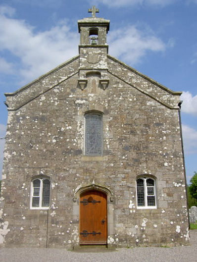 Saint Sedna's Church (Clongbeg)church/chapel · 999 yd
 Enclosure in BallynacourtyEnclosure · 1036 yd
 St. Johns WellHoly well · 1043 yd
 Bansha ForestForest · 1646 yd
 SlievenamuckMountain / peak · 1.5 mi
 Glen of AherlowViewpoint · 1.8 mi
 CurraghMountain / peak · 1.8 mi
 Site of Dungrot CastleCastle, unclassified · 1.8 mi
 Christ the KingViewpoint · 1.8 mi
 Giant's Rock - Rock of AglaishNamed rock · 1.9 mi