What is recorded here
Fairy fort in Ballyfoleen North is a shallow earthen ring, 38 by 40 metres, with an 8-metre gap at the south-east and a floor of nameless humps. It sits on a NW-facing slope in pasture, partly erased by a farm track and field boundary that still follow its curve. The bank stands only 0.3 metres outside, yet the shape remains clear enough to suggest people once drew a line around their own world. What they kept inside, or excluded, has not survived the grass.
In pasture, on NW-facing slope. Roughly circular area (38m N-S; 40m E-W) enclosed by denuded earthen bank (int. H 0.1m; ext. H 0.3m). Entrance at SE (Wth 8m). Interior slopes down to NW in sympathy with surrounding terrain. Interior surface is uneven, with numerous humps and hollows forming no discernible pattern. Field boundary just outside and concentric with enclosing bank S->W and NNE->SSE. From S->W farm track overlies denuded bank before veering off to W.
Compiled by: Denis Power
Date of upload: 26 August 2011
The monument record does not grant public access. Check the route and ask the landowner before entering private land.
- What survives
- Recorded monument
Places near here
 IndicatedFairy fort / earthen ringfort · 483 yd
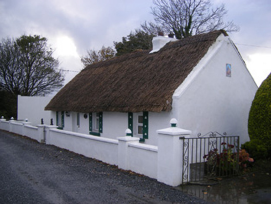 Leprechaun Cottagehouse · 526 yd
 Lismoylan - HachuredFairy fort / earthen ringfort · 662 yd
 KilnKiln, lime · 1179 yd
 Kilfinny CastleCastle · 1350 yd
 Kinnoor WellSpring · 1.2 mi
 Kilmacow Ho.Bawn · 1.4 mi
 Flat cemetery in Kiltenan SouthFlat cemetery · 1.5 mi
 KnockfeerinaMountain / peak · 2.3 mi
 Famine stoneMemorial · 2.3 mi
 Dysert AenghusaHeritage attraction · 2.9 mi
 GinkgoGinkgo · 3.9 mi