What is recorded here
Fairy fort in Ballyegny: a 35m ring of two earthen banks and a wide fosse, half swallowed by thorns and nettles on a north-facing slope. Cattle have rubbed the inner bank flat, yet the outer earth-and-stone wall still stands where field boundaries once touched it. The name suggests people saw more than livestock or farming: a hidden dwelling, a boundary marker, or a place where the ordinary world thinned.
In pasture, on break in N-facing slope. Site is covered by overgrowth and only arc of enclosing element NW->NE is accessible. Roughly circular area (diam. c. 35m) enclosed by two concentric earthen banks with intervening fosse. Inner bank (int. H 0.15m; ext. H 1.75m) is denuded by cattle at N. Outer bank of earth-and-stone (int. H 0.45m; ext. H 1.15m) best preserved SE->NE; at SE and NE it adjoins linear field boundaries, which extend eastwards to join a N-S field boundary. Break in outer bank (Wth c. 6m) at NNW where field boundary, which formerly abutted the bank, has been removed. Fosse wide and flat-bottomed (Wth 5m base). Interior densely overgrown with thorn bushes and nettles.
Compiled by: Denis Power
Date of upload: 26 August 2011
This remains an important historical record, but the official description says the monument is no longer visible or has been destroyed. The monument record does not grant public access. Check the route and ask the landowner before entering private land.
- What survives
- No visible remains or recorded as destroyed
Places near here
 Castle (in ruins)Castle, tower house · 881 yd
 Mound in KnockbweeheenMound · 1022 yd
 Kilcolman Church (in ruins)Church · 1190 yd
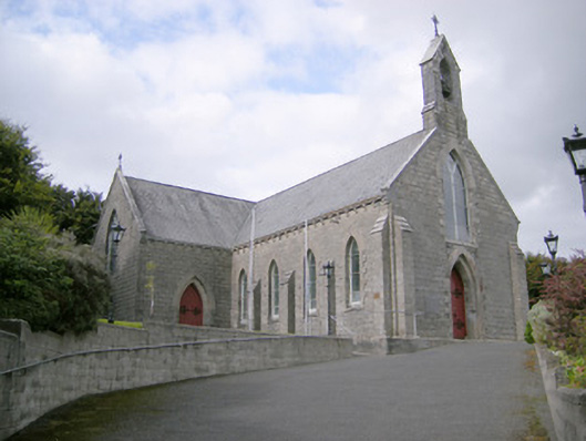 Saint Colman's Catholic Churchchurch/chapel · 1258 yd
 Lisnagreeve - Hachured (1923Fairy fort / earthen ringfort · 1543 yd
 CahermoyleCastle, unclassified · 1.6 mi
 St. Luke's WellSpring · 1.6 mi
 St. Kieran's WellSpring · 2.9 mi
 European ashEuropean ash · 5.5 mi
 Limerick GreenwayWalking route · 5.8 mi
 Monterey CypressMonterey Cypress · 6.4 mi
 Gammarel PointHeadland · 6.4 mi