What is recorded here
Forty feet across and gone, the ringfort at Ballyegny Beg has been erased by plough and time. What remains is a shallow dip in the grass, a ghost of a circle on the western slope. The land has forgotten its own shape, keeping only the memory of a border between inside and outside.
In gently undulating pasture, on W-facing slope and immediately W of public road. Monument, depicted on 1923 OS 6-inch map as embanked circular enclosure (diam. c. 35m), has been levelled. Only indication of site is slight hollow in field of grass.
Compiled by: Denis Power
Date of upload: 26 August 2011
The monument record does not grant public access. Check the route and ask the landowner before entering private land.
- What survives
- Recorded monument
Places near here
 Castle (in ruins)Castle, tower house · 248 yd
 IndicatedFairy fort / earthen ringfort · 626 yd
 Mound in Ballyegny BegMound · 774 yd
 Ballyegny Househouse · 832 yd
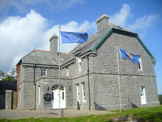 Rathgoonan Housecountry house · 1216 yd
 St. Luke's WellSpring · 1.3 mi
 CahermoyleCastle, unclassified · 1.3 mi
 St. Kieran's WellSpring · 2.3 mi
 European ashEuropean ash · 5.0 mi
 Limerick GreenwayWalking route · 6.1 mi
 Gammarel PointHeadland · 6.6 mi
 Monterey CypressMonterey Cypress · 6.8 mi