What is recorded here
Fairy fort in Ballinlongig is a sub-circular earthen ring, 37m by 27.5m, set in marshy pasture on an east-facing slope. Its bank stands 0.8m outside and 0.3m inside, with a shallow fosse running southeast to north-northeast, though a field boundary has cut through part of the enclosure. Cattle have poached the grassy interior, dense growth chokes the west third and bank, and a 5.3m gap at the southeast marks the entrance. The shape remains clear enough to suggest people once drew a line around their lives, excluded the marsh, and left the rest to legend.
In marshy pasture, on slight E-facing slope. Sub-circular area (37m N-S; 27.5m E-W) enclosed by earthen bank (int. H 0.3m; ext. H 0.8m), with external fosse (D 0.4m; Wth 1.75m) SE->NNE; enclosing element has been truncated by field boundary NNE->SE. Enclosing bank and W third of interior covered by dense overgrowth; otherwise interior is under pasture which is heavily poached by cattle. Interior accessed by gap (Wth 5.3m) between field boundary and enclosing bank at SE.
Compiled by: Denis Power
Date of upload: 26 August 2011
The monument record does not grant public access. Check the route and ask the landowner before entering private land.
- What survives
- Recorded monument
Places near here
 Enclosure in BallinlongigEnclosure · 979 yd
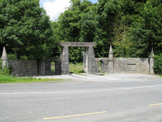 Springfield Castledemesne walls/gates/railings · 1435 yd
 Castle (in ruins), Springfield CastleCastle, tower house · 1465 yd
 Church (in ruins)Church · 1686 yd
 Burial GroundGraveyard · 1695 yd
 CastleCastle, unclassified · 1.5 mi
 ToberacappeenSpring · 1.6 mi
 National Co-op MuseumMuseum · 1.7 mi
 ToberhoranSpring · 1.9 mi
 Mullaghareirk - Banane LoopWalking route · 5.7 mi
 Ballagh MountainMountain / peak · 6.1 mi
 Rock HillMountain / peak · 8.1 mi