What is recorded here
Fairy fort / earthen ringfort in Ballingeary East, knockagh (Caher parish) is a fairy fort or earthen ringfort in Ballingeary East, knockagh (Caher parish), County Tipperary, Ireland. It stands on a hilltop under pasture, with a roughly circular raised area measuring 37 metres north-south and 34.5 metres east-west. A ploughed-out bank and external ditch remain visible, especially in the east quadrant where a broad outer bank also appears. The townland boundary cuts through the north quadrant, and its stone-revetted bank aligns with the monument's edge.
On summit of hill in generally undulating terrain, under pasture. An enclosure (TS076-037002-) is located immediately downslope to the S. According to the OS Letters 'it was the residence of Fearchios Mac Coman, the poet, who at the instigation of Cormac Mac Art, murdered Lughaidh Mac Con, King de facto of Ireland, who reigned 30 years. This place was anciently called Ard-na-nGeimhleach, i.e., altitudo vinculorum. When visited c. 1840 by the OS it was described as 'much injured…The circumvallation around it is nearly defaced...lime kiln was placed in extremity at northeast side; the side is still visible. A small portion remains on south west side in which was placed a lime kiln on the inside, as may be concluded from the appearance of the spot' (O'Flanagan 1930, vol. 2, 137-8). Ringfort levelled, however, still visible as raised, roughly circular area (diam. 37m N-S; 34.5m E-W). The OS Letters (ibid.) mention a bank surviving in the SE quadrant which is 'about four feet [1.2m] average height and eight feet [2.4m] in breadth at top in its present state'. The diameter is given as being about 'seventy paces = two hundred and ten feet [64m], the trench running around the foot (base) of the mound between it and the circumvallation being included' (ibid.), suggesting there was an external fosse. Townland boundary runs NE-SW along N quadrant, it has stone revetment on N face. According to OS 6-inch map the bank ran into the townland boundary (Wth 5m base; H above fosse 0.87m; H above ext. 1.57m) which curves out to respect or incorporate the site. However, the raised area (Wth 8m; H above fosse 0.42m; fosse Wth 9m) falls short of this (diam. N-S to townland boundary is c. 47m), possibly suggesting that the site was bivallate. Ploughed-out bank forms wide bank/scarp (Wth 14.6m; H above int. 0.41m; H above fosse 0.67m) with wide external fosse (Wth 5.2m), particularly evident in E quadrant where there is also an indication of an outer, broad bank (Wth 14.4m; H above fosse 0.32m; H above ext. 0.33m). Edge of ringfort in W quadrant is not very clear and S quadrant is quite reduced. Field boundary S of ringfort has been removed. Bank survives in townland boundary. Bank peters out when it does not correspond with the monument. Appears to be a break in fosse in E quadrant with slight causeway. According to Power (1908, 26) a house stood 'till recently within the lios'. House not indicated on 1st (1840) ed. OS 6-inch map. However, the OS Letters (ibid) mentions that the 'surface of the ground presents to view, as it were, the sites of some rectangular edifices, at least of two in number, which were, it would appear the foundations, built of stone'. This were probably the remains of the houses referred to by Power.
Compiled by: Jean Farrelly
Date of revised upload: 24 September 2014
A fairy fort or earthen ringfort in Ballingeary East, Knockagh, is likely an early-medieval defensive or domestic site, associated with Fearchios Mac Coman, a historical poet mentioned in the OS Letters. Such sites are often linked in folklore to supernatural or otherworldly inhabitants.
This remains an important historical record, but the official description says the monument is no longer visible or has been destroyed. The monument record does not grant public access. Check the route and ask the landowner before entering private land.
- What survives
- No visible remains or recorded as destroyed
Places near here
 Enclosure in Knockagh (caher Par.)Enclosure · 54 yd
 Enclosure in Rathmore (caher Par.)Enclosure · 1046 yd
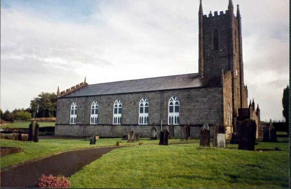 Ballylegan Church (in ruins)Church · 1511 yd
 Bawn in CastlecoyneBawn · 1.1 mi
 Moorstown CastleCastle, tower house · 1.1 mi
 Kill Church (in ruins)Church · 1.1 mi
 Caher AbbeyHeritage attraction · 3.0 mi
 Cahir CastleHeritage attraction · 3.1 miSiege of Cahir Castlesiege · 3.1 mi
 European YewEuropean Yew · 3.5 mi
 Cottagehill WoodForest · 3.5 mi
 Woodcock HillMountain / peak · 4.4 mi