What is recorded here
Fairy fort / earthen ringfort in Ardcurley is a fairy fort or earthen ringfort in Ardcurley, County Sligo, Ireland. It occupies a low rise in pasture about seventy metres west of the Unshin River. A roughly circular area measuring thirty to thirty-two metres across remains enclosed by a partially levelled earthen bank and a short external fosse visible only to the southwest.
In pasture, on a low rise c. 70m W of the Unshin River. A roughly circular area (int. diam. 32m NE-SW; 30m NW-SE) enclosed by the remains of an earthen bank and a short section of an external fosse. The bank is levelled N-E where the interior is truncated by a drain. Elsewhere the bank (int. H 0.3m) is poorly defined and slopes to the exterior for c. 3.5m. The fosse (Wth 4.5m; D 0.6m) is evident only S-W.
The above description is derived from the published 'Archaeological Inventory of County Sligo' compiled by Ursula Egan, Elizabeth Byrne, Mary Sleeman with Sheila Ronan and Connie Murphy (Dublin Stationery Office, 2005).
Date of upload: 18 January 2008
The monument record does not grant public access. Check the route and ask the landowner before entering private land.
- What survives
- Recorded monument
Places near here
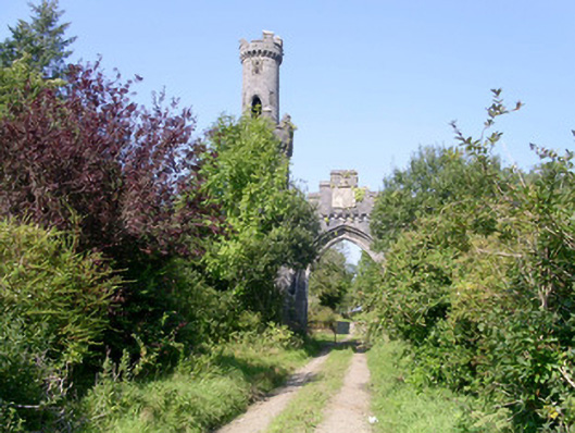 Markree Castlegate lodge · 503 yd
 Lisconny Bridgebridge · 750 yd
 LisconnyFairy fort / earthen ringfort · 1147 yd
 Indicated (1838).Fairy fort / earthen ringfort · 1331 yd
 Field MapleField Maple · 1.1 mi
 European ashEuropean ash · 1.4 mi
 Castle (Site of)Castle, unclassified · 1.5 mi
 CastleCastle, motte and bailey · 1.7 mi
 James MorrisonMemorial · 1.8 mi
 Giants GraveArchaeological place · 3.2 mi
 Riverstown Folk ParkHeritage attraction · 3.5 mi
 CroaghaunMountain / peak · 4.5 mi