
Places near here
Photo credits
- Sharon Loxton, Geograph · CC BY-SA 2.0
- kevin higgins, Geograph · CC BY-SA 2.0
- Ridiculopathy, Wikimedia Commons · CC0
- Oliver Dixon, Geograph · CC BY-SA 2.0
- Philip Pötsch, Philipweb, Wikimedia Commons · CC BY 4.0
- National Inventory of Architectural Heritage
- Frances Passey, Wikimedia Commons · CC BY-SA 2.0
- Wikimedia Commons contributor · CC BY-SA 3.0
 Cnoc DuíléibheMountain / peak · 1.2 mi
Explorer Tom There was a dance here that went on so long the participants turned into stone out of exhaustion. Cnoc Duíléibhe still…
 Piaras MórMountain / peak · 2.2 mi
Explorer Tom Piaras Mór stands beside one of the Dingle Way's most memorable mountain crossings, and it still insists on being more…
 CloghaunHut site · 4.7 mi
Explorer Tom Cloghaun is proud of its one surviving wall, having lost its twin in a mysterious argument. It's an oval drystone thing…
 Hachured, CloghaunFairy fort / earthen ringfort · 4.8 mi
Explorer Tom Cloghaun in Baile Na Bhfionnúrach is incredibly proud of its view, even though it’s just a circle with one stone wall…
 Caisleán PhiaraisCastle · 12 mi
Explorer Tom Caisleán Phiarais has a serious grudge against the rain and keeps building new walls just to spite it. It’s like a…
 Ceann an DúnaHeadland · 13 mi
Explorer Tom Ceann an Dúna is stuck showing off its vertical sandstone cliffs like it’s trying to impress Ferriter's Castle right…
 Dunmore HeadViewpoint · 16 mi
Explorer Tom Dunmore Head in County Kerry would tell a job interview it has excellent exposure to the Atlantic and zero patience for…
 An Dún MórHeadland · 16 mi
Explorer Tom An Dún Mór is the headland where a matchmaker once worked and successfully paired off two clouds that are still…
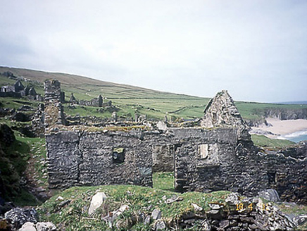 school17 mi
Explorer Tom School in Great-Blasket Island would handle a nosey neighbour by simply letting the wind do all the talking. It’s now a…
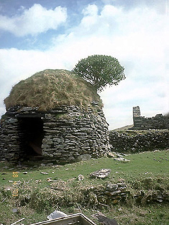 An Púicín BuíOutbuilding · 17 mi
Explorer Tom An Púicín Buí on Great Blasket would teach history by just sitting there looking round and mossy. It’s a beehive-shaped…
 Inis TuaisceartIsland · 19 mi
Explorer Tom Inis Tuaisceart would explain the 1800s to a teenager by saying, 'Imagine living in a mud hut but with much more…
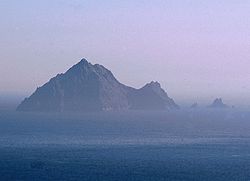 An TiarachtIslet · 23 mi
Explorer Tom An Tiaracht sits so far west that I would shout to America if the Atlantic ever quietened down. It is the westernmost…
More mountains and hills in County Kerry · All of County Kerry

What do you know about this place?Tap to add a comment or ask a question