What is recorded here
Identified in centre-line testing (E4110) in advance of the M11 Gorey to Enniscorthy road scheme, and set aside for resolution as a part of Corbally 4 (Hardy et al. 2010, 87-8). It is situated on a slight N-facing slope with a small E-W stream c. 90-100m to the N. It was fully excavated (E4241) by C. Hardy as an upper (dims 8.4m x 6m; T 0.2m) and lower (dims 9.5m x 8.4m; T 0.24m) spread of burnt and broken stone that were overlying a rectangular, flat-bottomed trough at their E edge. The trough was connected by a small channel with a circular concave addition at its W end (total dims 2.84m E-W; 1.98m N-S; D 0.35-0.51m) into which the trough could drain. A single large stake-hole was in each corner of the rectangular trough, suggesting that it may have been wood-lined, but no wood survived. Immediately to the E of the trough there was a total of 41 stake-holes in two concentrations, but no pattern could be discerned, and there was a large oval pit (dims 2.16m NE-SW; 1.44m; D 0.31m) just SW of the trough. The circular hut-site (WX020-115002-) is 8m NNW of the trough and outside the extent of the mound. The pits (WX020-114----) are c. 100m to the NNW. The corn-drying kiln (WX020-116----) is c. 80m to the SW, and the N perimeter of the enclosure (WX020-117001-) is c. 30m to the S. (Hardy and Rajic 2012; Hardy 2013)
Compiled by: Michael Moore
Date of upload: 28 November, 2013
The monument record does not grant public access. Check the route and ask the landowner before entering private land.
- What survives
- Recorded monument
Places near here
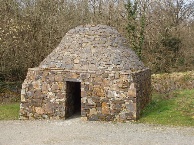 Hut site in Corbally (scarawalsh By.)Hut site · 1 yd
 Enclosure in Corbally (scarawalsh By.)Enclosure · 72 yd
 KilnKiln, corn-drying · 92 yd
 Kiln in Corbally (scarawalsh By.)Kiln · 229 yd
 Embanked enclosureCastle, motte · 2.0 mi
 Battle of Vinegar Hill, 1798Monument · 2.0 mi
 Vinegar HillMountain / peak · 2.1 mi
 Battle of Vinegar HillMajor battlefield · 2.7 mi
 U.N. Peace MemorialMonument · 2.7 mi
 Duffry GateMemorial · 2.8 mi
 National 1798 CentreMuseum · 2.8 mi
 Daphney CastleCastle, unclassified · 4.1 mi