
What is recorded here
Excavation is a small burnt pit in County Cork, discovered in 1986 while building the Bruff-Mallow gas pipeline. It measured 2.3 metres by 0.9 metres, sloped gently to a rounded base, and held charcoal, barley residue, oat and wheat remains. The pit may have served an ordinary household, marking a place where food was prepared, waste was discarded and fire changed the soil.
Discovered in 1986 during construction of Bruff-Mallow gas pipeline (Gowen 1988, 107-8, site 1/12/1 TR). Isolated oval pit (2.3m x 0.9m; max. D 0.42m) with gently sloping sides and rounded base; base deeper at NE end and heavily burnt in situ, burning overlaid by charcoal-rich fill. Charred plant remains, 'the residue from a six-row hulled barley crop' (ibid.), recovered from fill suggest pit was domestic in function; presence of common cultivated oat and short-grained bread wheat in sample 'suggestive of a late, rather than early, date for this pit' (ibid.).
The above description is derived from the published 'Archaeological Inventory of County Cork. Volume 4: North Cork' (Dublin: Stationery Office, 2000). In certain instances the entries have been revised and updated in the light of recent research.
Date of upload/revision: 14 January 2009
The monument record does not grant public access. Check the route and ask the landowner before entering private land.
- What survives
- Recorded monument
Places near here
 Burial Ground (Private)Graveyard · 517 yd
 Eglis a Dridin (in Ruins)Church · 549 yd
 Moated site in BallynadrideenMoated site · 629 yd
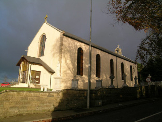 Saint Mary's Roman Catholic Churchchurch/chapel · 1119 yd
 CastleCastle, motte · 1642 yd
 Castle Harrison on Site of Castle (19*Castle, unclassified · 1.5 mi
 CarrigeenMountain / peak · 2.5 mi
 Ballyhoura WayWalking route · 2.6 mi
 Holy Cross CemeteryGraveyard · 2.8 mi
 BallinaboolaVisitor information · 3.0 mi
 Windmill HillMountain / peak · 3.2 mi
 Rogan's Rock CovertWood · 4.1 mi
Other information
Photo: Credit not shown in the picture search · Rights wording not checked; contact us if this picture should be removed